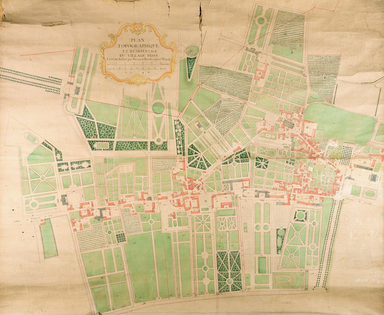
Topographical Map and Survey of the Village of Issy, 1740 by Bernard Borde

Topographical Map and Survey of the Village of Issy, 1740

(N11Seine87 Topographical Map and Survey of the Village of Issy, 1740 (pen, ink & wc on paper))


Bernard Borde

€ 110.72
Enthält 0% MwSt.
   Configure art print
1740  ·  pen, ink and watercolour on paper  ·  Picture ID: 364505

Nonclassified artists  ·  Cartography

Topographical Map and Survey of the Village of Issy, 1740 by Bernard Borde. Available as an art print on canvas, photo paper, watercolor board, uncoated paper or Japanese paper.
issy les moulineaux · issy les moulineaux · surveying · cartography · suburb · suburbs · Centre Historique des Archives Nationales, Paris, France / Bridgeman Images
zu Favoriten hinzufügen   Add to favorites    Select wall color    View painting in a room AR/3D   View in 3D / AR
0 Reviews

Configure art print

Picture Frame

Medium & Stretcher

Glass & Passepartout

Miscellaneous & Extras

 Save / compare configuration
Preview Icon

Summary

Gemälde
Veredelung
Keilrahmen
Museumslizenz

€ 110.72
(inkl. 20% MwSt)
   Add to cart

Bildschärfe: PERFEKT

Should you desire adjustments to brightness and color, or a custom crop of the motif, we are happy to make these changes at no additional cost to you. Please do not hesitate to contact us.

Similar artworks selected for you

General plan of the parks of the two Trianon Palaces, Versailles Plan of Versaille Detail of a Map of Paris showing the summit of Montagne Sainte-Genevieve, 1664 Estate Map Map of Villa Mansi and its gardens in Capannori, Italy Plan of Toulon Plan and survey of the castle, park and village of Fontainebleau Plan of the Villa del Poggio Imperiale The Parish of St. James Plan of Lucknow, plotted from a survey made in 1856, by Lieut. Moorsom, 52nd. Lt. Infantry. (Presented by Captain Moorsom, C.E.) Lucca (engraving) Kensington in 1764 Plan of London, Piccadilly, St. James The New and Accurate Plan of the Town and Port of Leverpool, from a survey, engraved by Thomas Kitchin Map of Sas de Gant and Surrounding Areas Plan of the Cities of London and Westminster and Borough of Southwark, Engraved by John Tinney, Published 1746 City map of Orleans, France Fecknam Manor, Worcester, 1744 A Topographical Survey of the Parish of Kensington with Plans and Elevations of the Royal Palace and Gardens, Hyde Park and Knightsbridge Plan of the Montreuil Estate of Madame Elisabeth Plan of Paris, 1676 Sheet 16 from: An exact survey of the cities of London and Westminster, the Borough of Southwark, with the country near ten miles round Map of the Forest and Manor of Fecknam Map of Florence Map of the city of Utrecht Plan of the Frederician Park of Sanssouci at Potsdam Nuova pianta di Roma by Giambattista Nolli, 1748, known as La Pianta Grande di Roma National Foundry of Ruelle Plan of the Hotel of Madame de Pompadour in Fontainebleau
Show more similar artworks

Other motives from the category Cartography

Map of Africa, from A map of Constantinople Map of Eastern North America: Florida to Chesapeake Bay Map of the Battle of Pultusk, Published by William Blackwood and Sons, Edinburgh and London Map of Paris at the Outbreak of the French Revolution, published by William Blackwood and Sons Map of the China Sea, from a Facsimile of the Map of London, 1852 Map of London Map of the Holy Land, based on descriptions and co-ordinates given in Cosmographica, by Ptolemy (Claudius Ptolemaeus of Alexandria) published in Ulm, Germany, by Johann Reger Map of Calicut, from Map of America and Directions to China Map charting Sir Francis Drake Map of Rocroi, from Map of Africa, Published in 1700, Paris Map Showing the Military Campaigns of Louis XIV in the Low Countries, from Atlas Géographique et Militaire, Published in Paris, 1763
View More from "Cartography"

Excerpt from our top sellers

Montage of 8 Pages from the Catalan Atlas by Cresques; the Then Known World The Dreamer Self-Portrait (Melancholy of the Mountains). 1929 Haboku-Sansui Apple Tree Standing Half-Nude with Brown Shirt The Garden of Earthly Delights Composition, 1930 The Grand Canal, Venice, Looking Southeast, with the Campo della Carità to the Right, 1730s Young Hare Two Men Contemplating the Moon Vesuvius in Eruption The Heart of the Andes Carnival Evening The Zaporozhye Cossacks Writing a Letter to the Turkish Sultan
Show More Artworks


What our customers think about us


Frequently Asked Questions about Meisterdrucke


Personalizing your art print at Meisterdrucke is a simple and intuitive process that allows you to design an artwork exactly to your specifications: Choose a frame, determine the image size, decide on a printing medium, and add suitable glazing or a stretcher frame. We also offer customization options such as mats, fillets, and spacers. Our customer service is available to help you design your perfect artwork.

At Meisterdrucke, you have the fascinating option to visualize the artwork you configured directly in your own space. For a tailored preview, simply upload a photo of your room and let the artwork appear on it. If you visit us via a mobile device, be it a phone or tablet, our augmented reality feature brings the image to life and seamlessly projects it into your space. An experience that uniquely combines art and technology.

Choosing the medium is often a matter of personal taste. To give you a clearer idea, we have provided some images for each medium. For a holistic experience, we also offer you a sample set of all paper variants so you can make a decision not just visually but also haptically. You can take advantage of the sample set free of charge – only the shipping costs will apply. You can order the sample set directly.

Do not worry. At Meisterdrucke, we do not proceed mechanically. We manually review each order. If there are any inconsistencies or peculiarities in the configuration, we will immediately contact you. Of course, our courteous and patient support is always at your side to assist you with the configuration. Together with you, we adjust your image by phone or email so that the final result exactly meets your expectations.


Do you have any questions?

Are you interested in an art print from our manufactory but still unsure? Do you need advice on choosing the medium or help with the order?

Our experts are happy to assist you.

+43 4257 29415
support@meisterdrucke.com
Mo-Do: 7:00 - 16:00 | Fr: 7:00 - 13:00

Do you have any questions?

Are you interested in an art print from our manufactory but still unsure? Do you need advice on choosing the medium or help with the order?

Our experts are happy to assist you.

+43 4257 29415
support@meisterdrucke.com
Mo-Do: 7:00 - 16:00 | Fr: 7:00 - 13:00


Meisterdrucke

   Kärntner Strasse 46
        9586 Finkenstein am Faaker See
        Austria
        +43 4257 29415
        support@meisterdrucke.com
Other languages

                   
Erfahrungen & Bewertungen zu Meisterdrucke
Partner Logos

Kaiser Franz Joseph

Meisterdrucke
Kärntner Strasse 46
9586 Finkenstein am Faaker See · Austria
+43 4257 29415 · office@meisterdrucke.com
Partner Logos


(c) 2025 meisterdrucke.us