Search by artist, work title or style – e.g. Monet, Starry Night, Impressionism, Hokusai wave, nude. Describe the scene – e.g. green meadow, abstract with lots of red, dark oil painting, standing nude next to a tree.

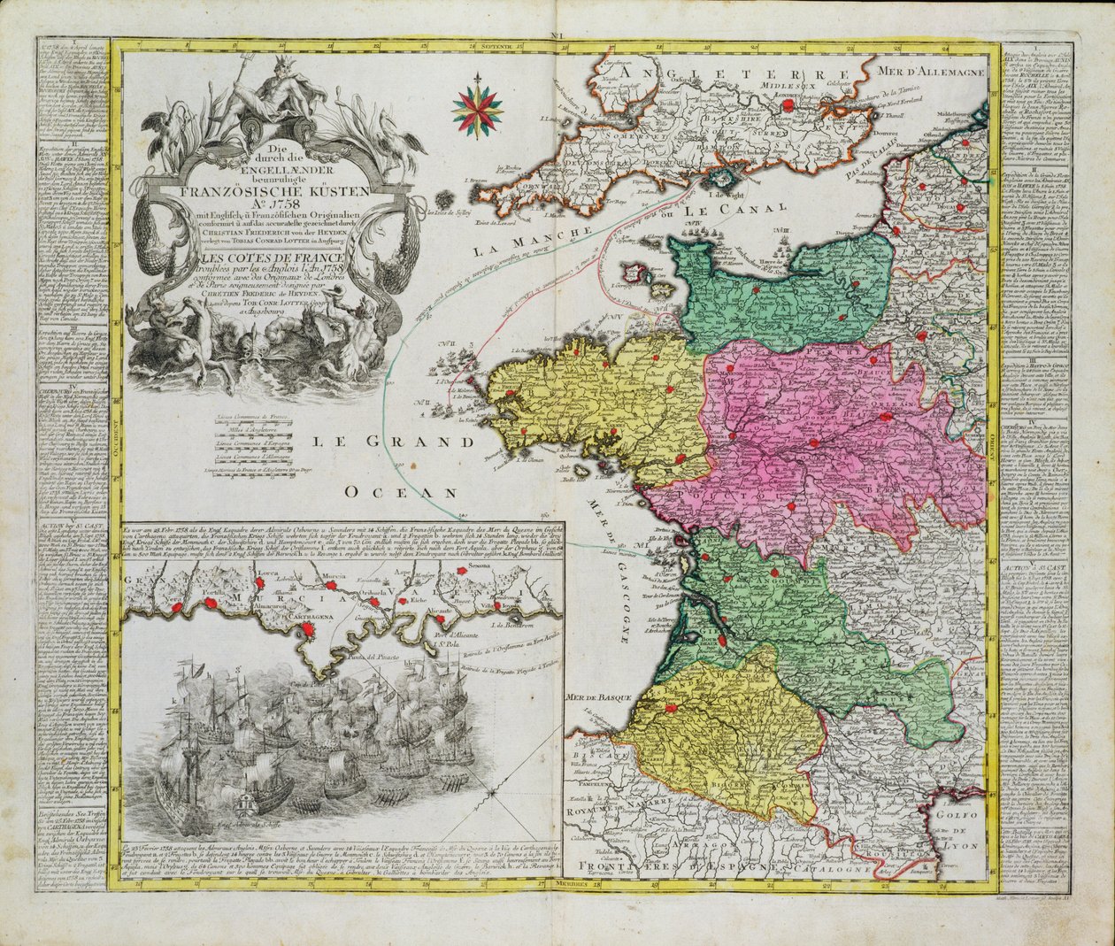
German Map Showing English Naval Attacks on French Ports in 1758 by German School

German Map Showing English Naval Attacks on French Ports in 1758

(German Map showing English naval attacks on French ports in 1758 )


German School

€ 110.15
Enthält 0% MwSt.
   Configure art print
Undated  ·  coloured engraving  ·  Picture ID: 413922

Cultural Circles  ·  Cartography

German Map Showing English Naval Attacks on French Ports in 1758 by German School. Available as an art print on canvas, photo paper, watercolor board, uncoated paper or Japanese paper.
seven years war · year · anglo-french · navy · france · Private Collection / Bridgeman Images
AR/3D   View in 3D / AR zu Favoriten hinzufügen   Add to favorites    Select wall color    View painting in a room
0 Reviews

Configure art print

Picture Frame

Medium & Stretcher

Glass & Passepartout

Miscellaneous & Extras

 Save / compare configuration
Preview Icon

Summary

Gemälde
Veredelung
Keilrahmen
Museumslizenz

€ 110.15
(inkl. 20% MwSt)
   Add to cart

Bildschärfe: PERFEKT

Should you desire adjustments to brightness and color, or a custom crop of the motif, we are happy to make these changes at no additional cost to you. Please do not hesitate to contact us.

Similar artworks selected for you

The English Channel Nord-Pas-de-Calais, Picardy, Upper Normandy, Lower Normandy, north Centre) Channel Islands, France Portugal and Algarve Map of the Region of Map of Normandy, 1694, from Le Theatre du Monde, by Jean-Baptiste Nolin, Published 1717 Map of the Kingdom of France France France Map of the Kingdom of France Map of the Western Mediterranean Countries: France, Spain, Portugal and North Africa, with the Balearic Islands, Corsica and Sardinia New Description of the Duchy of Brittany with All Its Provinces Spain, France (with Corsica), Belgium, Germany (State: North Rhine-Westphalia, south Lower Saxony, south Saxony-Anhalt, Hesse, Thuringia, Saxony, Rhineland-Palatinate, Saarland, Baden-Württemberg, Bavaria), Luxembourg, Austria, Switzerland, Italy (Region: Belgium and Holland Europe divided into its main states, engraving by G. Zuliani taken from Tome I of the Newest Atlas published in Venice in 1776 by Antonio Zatta Netherlands Map of the United Provinces of the Netherlands Map of Holland, showing settlements, marshes, woodlands, hills, roads, rivers and other geographical features. Shows title in a decorative cartouche to the upper left with Fame, Neptune and Thetis accompanied by putti bearing the arms of the United Provinc Map of France as Divided into 58 Provinces Map of the Belgian Federation (Belgium) (etching) Gloucester Shire and Monmouth Shire Map Showing Portugal Map of Bavaria Asian Turkey, Including Antolia, Georgia, Armenia, Kurdestan, Diarbec, Irak-Arabi, Syria, Engraving by G. Zuliani France, in Duchy of Schleswig Northern Part A Map of England Map of Holland, Showing Settlements, Marshes, Woodlands, Hills, Roads, Rivers and Other Geographical Features, c.1710 Map of the Kingdom of Portugal Map of the diocese of Uzes (France)
Show more similar artworks

Other art prints by German School

Poster advertising the Hamburg-Amerika Line Wyk auf Föhr, Poster Advertising the Wyk Steam Shipping Company, 1897 Poster advertising the Hamburg-Amerika Line Poster for the Industrial Exhibition in Berlin, Germany, 1896 Woman Bathing Arthur Schopenhauer St. Brendan and a Siren, from the German Translation of Navigatio Sancti Brendani Abbatis Portrait of Kaiser Wilhelm II (1859-1941) Poster Advertising the German East Africa Line, 1890 Sylt North Sea Baths, Poster Advertising the Sylt Steamship Company, 1893 Poster advertising Hamburg-Amerika Linie routes to the West Indies and Central America The Cosmic Spheres and Human Being, vision of Hildegard of Bingen from "Liber Divinorum Operum", c.1220-30 The Whore of Babylon, from the Luther Bible Fantastic Depiction of the Solar System Battle in the streets of Bazeilles, Franco-Prussian War, 1 September 1870
Discover more works by German School

Other motives from the category Cartography

The first western atlas map of China, from the Ortelius Theatrum atlas, 1584 Map of North America, 1747 Map of Cutch and Bombay Presidency, India, 1898 Map to Illustrate the War of American Independence, from Map of Tartary Map of North-East China, Showing the Gulf of Pechili, the Tien-Tsin (Peiho) River, and the Approaches to Pekin Map from Gulliver Map of the Caribbean islands Map of Countries First Discovered by Christopher Columbus (1451-1506) 1500 Map of Ireland showing the Provinces of Ulster, Munster, Connaught and Leinster, by Johann B. Homann, c.1730 Map illustrating the Naval Attack on England by Napoleon Bonaparte, c.1803-04 Map of the St. Lawrence Estuary Map of Laputa (flying island top right) and Balnibarbii (main port Maldonada) from Part III: A Voyage to Laputa, Balnibarbi, Luggnagg, Glubbdubdrib, and Japan in Gulliver A Map of Chelsea, 1746 Map of the Valley of Mexico at the Time of the Conquest, from History of The Conquest of Mexico, published 1850
View More from "Cartography"

Excerpt from our top sellers

The Convalescent. 1888 Farm Garden with Sunflowers The Two Crowns The Dreamer The Soul of the Rose, 1908 The Magpie Paradiso, Canto 31: The saintly throng form a rose in the empyrean Impression, Sunrise Dance at Le Moulin de la Galette The Seasons: Autumn, 1896 Horse Study The Wild Rabbit Poster, 1899 Cat in a Rainbow The Great Wave off Kanagawa Sheerness as Seen from the Nore
Show More Artworks


What our customers think about us


Frequently Asked Questions about Meisterdrucke


Personalizing your art print at Meisterdrucke is a simple and intuitive process that allows you to design an artwork exactly to your specifications: Choose a frame, determine the image size, decide on a printing medium, and add suitable glazing or a stretcher frame. We also offer customization options such as mats, fillets, and spacers. Our customer service is available to help you design your perfect artwork.

At Meisterdrucke, you have the fascinating option to visualize the artwork you configured directly in your own space. For a tailored preview, simply upload a photo of your room and let the artwork appear on it. If you visit us via a mobile device, be it a phone or tablet, our augmented reality feature brings the image to life and seamlessly projects it into your space. An experience that uniquely combines art and technology.

Choosing the medium is often a matter of personal taste. To give you a clearer idea, we have provided some images for each medium. For a holistic experience, we also offer you a sample set of all paper variants so you can make a decision not just visually but also haptically. You can take advantage of the sample set free of charge – only the shipping costs will apply. You can order the sample set directly.

Do not worry. At Meisterdrucke, we do not proceed mechanically. We manually review each order. If there are any inconsistencies or peculiarities in the configuration, we will immediately contact you. Of course, our courteous and patient support is always at your side to assist you with the configuration. Together with you, we adjust your image by phone or email so that the final result exactly meets your expectations.


Do you have any questions?

Are you interested in an art print from our manufactory but still unsure? Do you need advice on choosing the medium or help with the order?

Our experts are happy to assist you.

+43 4257 29415
support@meisterdrucke.com
Mo-Do: 7:00 - 16:00 | Fr: 7:00 - 13:00

Do you have any questions?

Are you interested in an art print from our manufactory but still unsure? Do you need advice on choosing the medium or help with the order?

Our experts are happy to assist you.

+43 4257 29415
support@meisterdrucke.com
Mo-Do: 7:00 - 16:00 | Fr: 7:00 - 13:00


Meisterdrucke

   Kärntner Strasse 46
        9586 Finkenstein am Faaker See
        Austria
        +43 4257 29415
        support@meisterdrucke.com
Other languages

                   
Erfahrungen & Bewertungen zu Meisterdrucke
Post.at DHL Express Quehenberger Cargoboard
Kaiser Franz Joseph

Meisterdrucke
Kärntner Strasse 46
9586 Finkenstein am Faaker See · Austria
+43 4257 29415 · office@meisterdrucke.com
Post.at DHL Express Quehenberger Cargoboard


Meisterdrucke 2758 Bewertungen auf ProvenExpert.com

(c) 2025 meisterdrucke.us