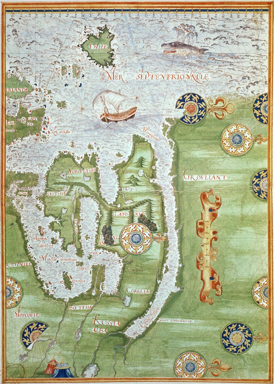
Fol.10v Map of Scandinavia and Northern Russia, from

Fol.10v Map of Scandinavia and Northern Russia, from 'Cosmographie Universelle'

(Fol.10v Map of Scandinavia and Northern Russia, from 'Cosmographie Universelle', 1555 )


Guillaume Le Testu

€ 0.00
Enthält ??% MwSt.
   Add to cart
   Configure art print
1555  ·  Wasserfarbe auf Papier  ·  Picture ID: 113304

Nonclassified artists  ·  Cartography

Fol.10v Map of Scandinavia and Northern Russia, from 'Cosmographie Universelle' by Guillaume Le Testu. Available as an art print on canvas, photo paper, watercolor board, uncoated paper or Japanese paper.
scandinavia · northern russia · north · finland · norway · greenland · scandinavian · ocean · Renaissance · Min. Defense - Service Historique de l'Armee de Terre,France / Bridgeman Images
zu Favoriten hinzufügen   Add to favorites    Select wall color    View painting in a room AR/3D   View in 3D / AR
0 Reviews

Configure art print

Picture Frame

Medium & Stretcher

Glass & Passepartout

Miscellaneous & Extras

 Save / compare configuration
Preview Icon

Summary

Gemälde
Veredelung
Keilrahmen
Museumslizenz

€ 121.36
(inkl. 20% MwSt)
   Add to cart

Bildschärfe: PERFEKT

Should you desire adjustments to brightness and color, or a custom crop of the motif, we are happy to make these changes at no additional cost to you. Please do not hesitate to contact us.

Similar artworks selected for you

Map of Australia and Magellan Island from Map of the Sea of Maluku, from the Cosmographie Universelle Map of the Magellan Straits, from Map of Peru, from Map of Australia, from Map of Australia, from The Spice Trade in the Moloccas, from Map of the Magellan Straits, from Northern Europe, from Atlas of the World in thirty-three Maps Map of Netherlands, from Theatrum Orbis Terrarum by Abraham Ortelius Map of the China Sea, from a Facsimile of the Map of Smerwick, Ireland, Showing the English Earthwork with Two Guns for Attacking the Spanish Fort and English Soldiers Marching Out of Castell More Oversize Atlas Titled Dutch Trade Map of the Baltic Sea Map of Brasil, from Map of Europe, from a Facsimile of the Northern Europe: Iceland, from Atlas of the World in thirty-three Maps Eastern Europe and Central Asia, from Atlas of the World in Thirty-Three Maps The famous West Indian voyage made by the English Fleet of 23 ships and barks wherein were gotten the towns of St. Iago, Sto Domingo, Cartagena and St. Augustines Map of Asia, Including Armenia, Iran, Afghanistan, with Wind Rose, Details of Ports, Coasts and Sea Routes, in Atlas de Joan Martines Planisphere Showing the Different Climatic Zones Map of Cartagena View of the Archipelago of Borneo (detail) Illustration from the Map, illustration from the Portland Bill to Portsmouth: The Pursuit of the Spanish Armada by the English Fleet Map of Florida and the Antilles, from Map of Colombia and Peru. 1590. Siege of Malta (detail)
Show more similar artworks

Other art prints by Guillaume Le Testu

Map of Florida, Canada and Labrador (from Map of Brasil, from Fol.10v Map of Scandinavia and Northern Russia, from Map of the North Pole, from Map of Australia, from Map of Western Europe, from Map of the Magellan Straits, from Map of Peru, from Map of Australia and Magellan Island from Map of Canada and Florida, from Map of Florida, from Map of Florida and the Antilles, from Map of Australia, from Map of the Magellan Straits, from Map of the Sea of Maluku, from the Cosmographie Universelle
Discover more works by Guillaume Le Testu

Other motives from the category Cartography

Map of Warsaw, from Jerusalem and Damascus (detail) from a Renaissance map of Europe, 1528 Aztecs consulting and following a map, from the Map of Europe Northern Africa and Western Asia, Orbis Veteribus Notus, from Map of Laos and the Mekong River Showing the Route of the Voyage of Henri Mouhot, Illustration from Travels in the Central Parts of Indo-China (Siam), Cambodia, and Laos During the Years 1858, 1859 Map of Toledo and Valladolid (from Map of Laputa (flying island top right) and Balnibarbii (main port Maldonada) from Part III: A Voyage to Laputa, Balnibarbi, Luggnagg, Glubbdubdrib, and Japan in Gulliver Mappa Mundi, from a Bestiary, c.1200-30 Map of the Battle of Aspern or Essling Map of Regensburg, from Map of Salzburg from Cartouche from Map of the Kingdom of Great Britain and Ireland, 1610 Tombleson Cartouche from a Map of the Cevennes Region, 1703
View More from "Cartography"

Excerpt from our top sellers

Reduced Weight Dante and Virgil Danaë The Japanese Footbridge and the Water Lily Pool, Giverny Silent Night Roses The Geese World Map Universalis Cosmographia, 1507 Fish Magic Woman with a Veil St. Paul Limits of Reason, 1927 The Heart of the Andes Forest Lilith
Show More Artworks


What our customers think about us


Frequently Asked Questions about Meisterdrucke


Personalizing your art print at Meisterdrucke is a simple and intuitive process that allows you to design an artwork exactly to your specifications: Choose a frame, determine the image size, decide on a printing medium, and add suitable glazing or a stretcher frame. We also offer customization options such as mats, fillets, and spacers. Our customer service is available to help you design your perfect artwork.

At Meisterdrucke, you have the fascinating option to visualize the artwork you configured directly in your own space. For a tailored preview, simply upload a photo of your room and let the artwork appear on it. If you visit us via a mobile device, be it a phone or tablet, our augmented reality feature brings the image to life and seamlessly projects it into your space. An experience that uniquely combines art and technology.

Choosing the medium is often a matter of personal taste. To give you a clearer idea, we have provided some images for each medium. For a holistic experience, we also offer you a sample set of all paper variants so you can make a decision not just visually but also haptically. You can take advantage of the sample set free of charge – only the shipping costs will apply. You can order the sample set directly.

Do not worry. At Meisterdrucke, we do not proceed mechanically. We manually review each order. If there are any inconsistencies or peculiarities in the configuration, we will immediately contact you. Of course, our courteous and patient support is always at your side to assist you with the configuration. Together with you, we adjust your image by phone or email so that the final result exactly meets your expectations.


Do you have any questions?

Are you interested in an art print from our manufactory but still unsure? Do you need advice on choosing the medium or help with the order?

Our experts are happy to assist you.

+43 4257 29415
support@meisterdrucke.com
Mo-Do: 7:00 - 16:00 | Fr: 7:00 - 13:00

Do you have any questions?

Are you interested in an art print from our manufactory but still unsure? Do you need advice on choosing the medium or help with the order?

Our experts are happy to assist you.

+43 4257 29415
support@meisterdrucke.com
Mo-Do: 7:00 - 16:00 | Fr: 7:00 - 13:00


Meisterdrucke

   Kärntner Strasse 46
        9586 Finkenstein am Faaker See
        Austria
        +43 4257 29415
        support@meisterdrucke.com
Other languages

                   
Erfahrungen & Bewertungen zu Meisterdrucke
Partner Logos

Kaiser Franz Joseph

Meisterdrucke
Kärntner Strasse 46
9586 Finkenstein am Faaker See · Austria
+43 4257 29415 · office@meisterdrucke.com
Partner Logos


(c) 2025 meisterdrucke.us