Search by artist, work title or style – e.g. Monet, Starry Night, Impressionism, Hokusai wave, nude. Describe the scene – e.g. green meadow, abstract with lots of red, dark oil painting, standing nude next to a tree.

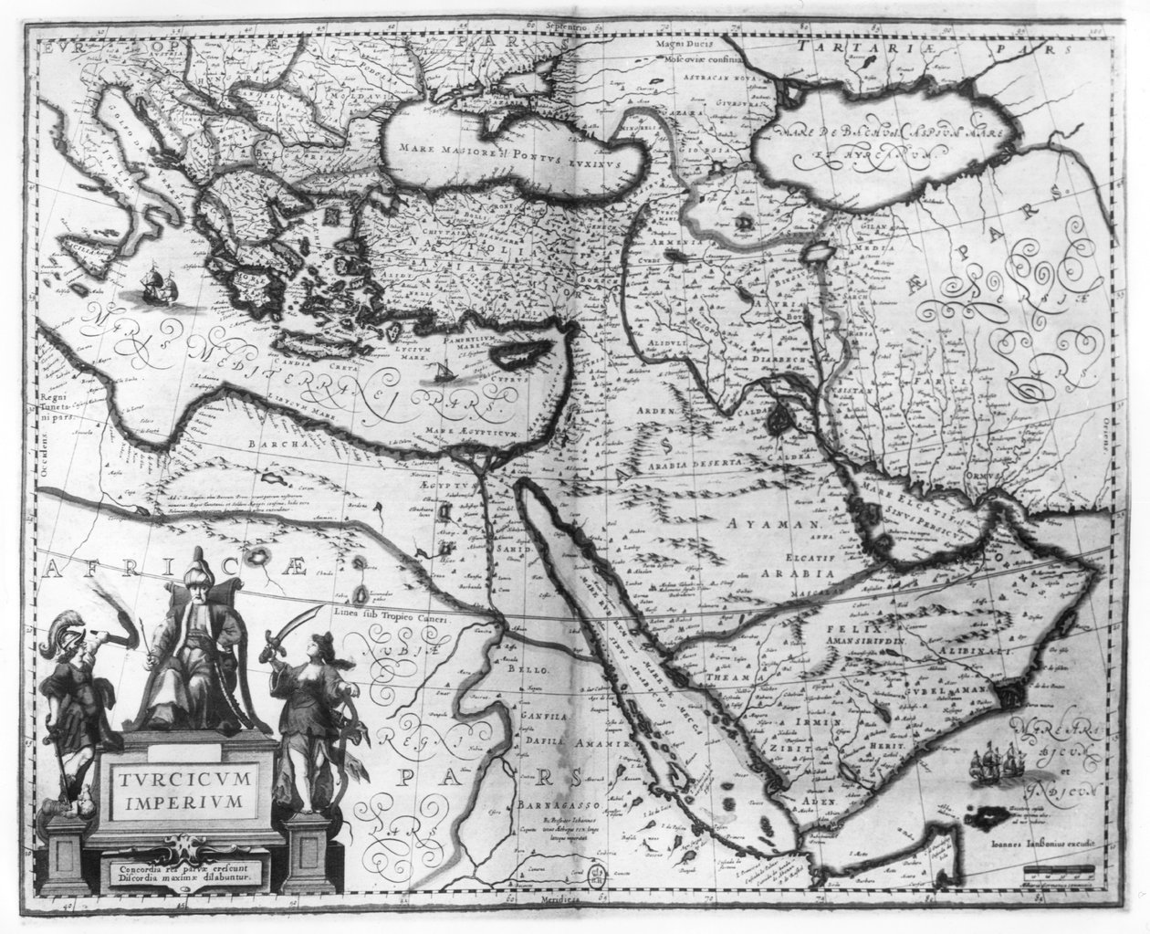
Map of the Ottoman Empire, from the

Map of the Ottoman Empire, from the 'Atlas Novus'

(Map of the Ottoman Empire, from the 'Atlas Novus' )


Joannes Jansson

€ 114.89
Enthält 0% MwSt.
   Configure art print
Undated  ·  coloured engraving  ·  Picture ID: 52510

Nonclassified artists  ·  Cartography

Map of the Ottoman Empire, from the 'Atlas Novus' by Joannes Jansson. Available as an art print on canvas, photo paper, watercolor board, uncoated paper or Japanese paper.
map of the turkish empire · turkish empire · theater of the world · mercator-hondius · turk · turkey · print · cartouche · jan jansson · jean · Bibliotheque Nationale, Paris, France / Bridgeman Images
AR/3D   View in 3D / AR zu Favoriten hinzufügen   Add to favorites    Select wall color    View painting in a room
0 Reviews

Configure art print

Picture Frame

Medium & Stretcher

Glass & Passepartout

Miscellaneous & Extras

 Save / compare configuration
Preview Icon

Summary

Gemälde
Veredelung
Keilrahmen
Museumslizenz

€ 114.89
(inkl. 20% MwSt)
   Add to cart

Bildschärfe: PERFEKT

Should you desire adjustments to brightness and color, or a custom crop of the motif, we are happy to make these changes at no additional cost to you. Please do not hesitate to contact us.

Similar artworks selected for you

Turkish Empire, in Accurate and Large Map of the Entire Turkish Empire with All Its Regions History. Ancient Greece. The travels of Alexander the Great. Engraving in : Le theatre du monde, atlas by G. Blaeu, Amsterdam A Map of Turkish Possessions Including Egypt and Greece 1692 Map of the Turkish Empire in Europe, Asia and Africa Forty Years Travels of the Children of Israel Italy, Balkan Peninsula, Turkey, Lebanon, Syria, Israel, Jordan, Iraq, Arabian Peninsula, Iran Map of the Turkish Empire Map of Ottoman Empire A New Map of Asia Map of the Travels and the Expeditions of Alexander the Great in Asia Turkey - Arabia and Iran Turkey, Cyprus, Lebanon, Syria, Israel, Jordan, Iraq, Arabian Peninsula, Iran, Turkmenistan, Afghanistan, Pakistan Map of the Travels of Alexander the Great (356-323 BC) from The Turkish Empire, from Persian Empire, in Turkey, Balkans, northeastern Africa, Arabia and the Middle East (engraving) A New & Accurate Map of Persia, with the Adjacent Countries Map of Persia (Iran), Armenia, Anatolia (Turkey) and Arabia (Arabian Peninsula: Saudi Arabia, Kuwait, United Arab Emirates, Oman, Qatar, Yemen, Bahrain) Map of the Turkish Empire, from the Mercator Atlas pub. by Jodocus Hondius Amsterdam, 1606 Map of the travels of Abraham, Isaac and Jacob, 1652 Map of the Middle East, from Theatrvm Orbis Terrarvm, 1570 Map of the Ottoman and Persian Empires (Cropped) East Europe and Asia The Turkish Empire in Europe, Asia and Africa Map of Tavernier Friuli, Italy - Slovenia (Istria) with the Gulf of Trieste and Balkans (engraving) Map of the Old World The Old World for Better Understanding of Ancient Histories 17th Century Map of the Eastern Mediterranean by Stefano Scolari
Show more similar artworks

Other art prints by Joannes Jansson

Map of the Ottoman Empire, from the Map showing the Molucca Islands off Halmahera, 1640 America Pars Meridionalis, page 93 of Map of New Belgium with a View of New Amsterdam, compiled by Nicolaes Visscher c.1651-55 Map showing the Molucca Islands off Halmahera, 1640 Representation of the Seven Wonders of Antiquity: the Colossus of Rhodes. Atlas of Jansson Jannsonius, 1630 Representation of the Seven Wonders of Antiquity: the Temple of Diana (Artemis) in Ephesus. Atlas of Jansson Jannsonius, 1630 Historical Geographical Map of Palestine. Jansson Atlas New Map of Switzerland The Antarctic Pole Frontispiece of the Fifth Volume of Jansson Representation of the Seven Wonders of Antiquity: the Gardens of Babylon. Atlas of Jansson Jannsonius, 1630 Sichuan and Shanxi, China Representation of the Seven Wonders of Antiquity: The Statue of Jupiter by Phidias in Representation of the Seven Wonders of Antiquity: The Mausoleum of Halicarnassus in the Atlas by Jansson Jannsonius
Discover more works by Joannes Jansson

Other motives from the category Cartography

Detail of Copy of a Catalan Map of Europe and North Africa, presented to Charles V of France in 1381 Detailed map of Gallipoli Peninsula and the Dardanelles Turkey, from Map showing Tycho Brahe Map of the Country between Auckland and the River Waikato, New Zealand, illustrating the War with the Natives Improved Map of India published in London 1820 Descriptive map of London poverty, 1889 Map of the Austrian Empire Map of Guildhall, London, and Surrounding Area About 1750 Map of Animals in North America Map of America, 1878 Map of Britain and Ireland, published Paris 1640 Map of Lubeck and Hamburg, from Map of the Suez Canal accompanied by different views and portraits of Ferdinand de Lesseps and Ismail Pasha, 1869 Map of Mexico or New Spain, 1625 Map of Animals in Africa
View More from "Cartography"

Excerpt from our top sellers

View of a Harbor Farm Garden with Sunflowers Sunset Over the Lake The Geneva Window, eight panels depicting scenes from early Irish literature Poster advertising the Hamburg-Amerika Line Seated Woman with Raised Knee Two Girls in White and Blue Dress Annunciation (post restoration) Ball at the Moulin de la Galette Alley in Arles with Houses The Wild Hunt of Odin Lute Player Flowers in a Crystal Vase Whimsical, 1930 The Garden at Giverny, 1900
Show More Artworks


What our customers think about us


Frequently Asked Questions about Meisterdrucke


Personalizing your art print at Meisterdrucke is a simple and intuitive process that allows you to design an artwork exactly to your specifications: Choose a frame, determine the image size, decide on a printing medium, and add suitable glazing or a stretcher frame. We also offer customization options such as mats, fillets, and spacers. Our customer service is available to help you design your perfect artwork.

At Meisterdrucke, you have the fascinating option to visualize the artwork you configured directly in your own space. For a tailored preview, simply upload a photo of your room and let the artwork appear on it. If you visit us via a mobile device, be it a phone or tablet, our augmented reality feature brings the image to life and seamlessly projects it into your space. An experience that uniquely combines art and technology.

Choosing the medium is often a matter of personal taste. To give you a clearer idea, we have provided some images for each medium. For a holistic experience, we also offer you a sample set of all paper variants so you can make a decision not just visually but also haptically. You can take advantage of the sample set free of charge – only the shipping costs will apply. You can order the sample set directly.

Do not worry. At Meisterdrucke, we do not proceed mechanically. We manually review each order. If there are any inconsistencies or peculiarities in the configuration, we will immediately contact you. Of course, our courteous and patient support is always at your side to assist you with the configuration. Together with you, we adjust your image by phone or email so that the final result exactly meets your expectations.


Do you have any questions?

Are you interested in an art print from our manufactory but still unsure? Do you need advice on choosing the medium or help with the order?

Our experts are happy to assist you.

+43 4257 29415
support@meisterdrucke.com
Mo-Do: 7:00 - 16:00 | Fr: 7:00 - 13:00

Do you have any questions?

Are you interested in an art print from our manufactory but still unsure? Do you need advice on choosing the medium or help with the order?

Our experts are happy to assist you.

+43 4257 29415
support@meisterdrucke.com
Mo-Do: 7:00 - 16:00 | Fr: 7:00 - 13:00


Meisterdrucke

   Kärntner Strasse 46
        9586 Finkenstein am Faaker See
        Austria
        +43 4257 29415
        support@meisterdrucke.com
Other languages

                   
Erfahrungen & Bewertungen zu Meisterdrucke
Post.at DHL Express Quehenberger Cargoboard
Kaiser Franz Joseph

Meisterdrucke
Kärntner Strasse 46
9586 Finkenstein am Faaker See · Austria
+43 4257 29415 · office@meisterdrucke.com
Post.at DHL Express Quehenberger Cargoboard


Meisterdrucke 2758 Bewertungen auf ProvenExpert.com

(c) 2025 meisterdrucke.us