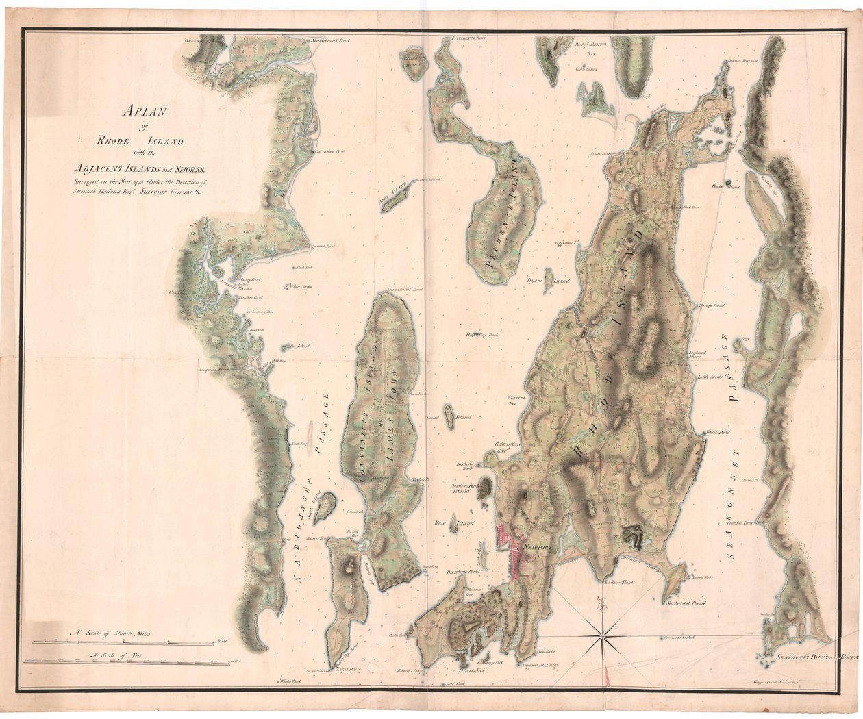
A Plan of Rhode Island by Holland by Dutch School

A Plan of Rhode Island by Holland


Dutch School

€ 0.00
Enthält ??% MwSt.
   Add to cart
   Configure art print
Undated  ·  manuscript  ·  Picture ID: 1467031

Cultural Circles

A Plan of Rhode Island by Holland by Dutch School. Available as an art print on canvas, photo paper, watercolor board, uncoated paper or Japanese paper.
18th century · xviiith century · xviii · c18th · eighteenth century · 18 18th xviii xviiith century · 18 18th 18th 18th 18th 18th century · 18 18th 18th 18th xviii 18th century · 18 18th xviii 18th century · early 18th century · 18 18th xviii xviiith eighteenth century · 18th centuries · colour · color · coloured · colors · colours · colored · united states · u.s.a · united states of america · unites states of america · american · americans · america · u.s.a. · america american americans · ameerican · american american american american american american american american american · .usa · us-american · north america · america (continent) · americae · geography · geographer · manuscript · maps · Rhode Island · print · mzprint · · Collection of the Duke of Northumberland, Syon House, London, UK / Bridgeman Images
zu Favoriten hinzufügen   Add to favorites    Select wall color    View painting in a room AR/3D   View in 3D / AR
0 Reviews

Configure art print

Picture Frame

Medium & Stretcher

Glass & Passepartout

Miscellaneous & Extras

 Save / compare configuration
Preview Icon

Summary

Gemälde
Veredelung
Keilrahmen
Museumslizenz

€ 109.31
(inkl. 20% MwSt)
   Add to cart

Bildschärfe: PERFEKT

Should you desire adjustments to brightness and color, or a custom crop of the motif, we are happy to make these changes at no additional cost to you. Please do not hesitate to contact us.

Similar artworks selected for you

Chart of Ipswich Bay and Cape Ann, Atlantic coast of North America A Topographical Chart of Rhode Island A Chart of the Harbour of Rhode Island and Narragansett Bay A Chart of the Harbour of Rhode Island and Narraganset Bay Plan of the Harbour, Fort, Town and Environs of Fort Royal in Martinique Plan of the taking of Barasound in Finland A plan of Fort Montgomery & Fort Clinton, 1774-1779 Map from the National Library A Plan of the Town and Harbour of Boston and the Country adjacent Ipswich Bay and Cape Ann Hand Colored Map Showing Location of British and American Forces A Map of Nautical Remarks on Observations for the Chart of the Harbour of Boston Map of Callao & Lima The south west coast of Ireland from the Staggs of Castle Haven to Dursey I. Surveyed and navigated by M. Mackenzie Sen. 1775. Chart of Cork Harbour, Ireland Chart of Galapagos Islands Surveyed During Voyage of HMS Maps 8.Tab.C.8.80 Title Vignette and Prospect for Map of Christiansø Plano del Puerto y Rio Guayaquil en el Mar de el Sur Manuscript Map of the Southern Portion of the Red Sea from the Horn of Africa and Yemen up to Jiddah, c.1740 A Plan of the Operations of the British Forces in Egypt from the Landing in Aboukir Bay on the 8th of March to the Battle of Alexandria March 21st Inclusive Coast of New England from Narragansett to Cape Cod Plan of the Island of Bequia laid down by actual survey under the direction of the Honorable the Commissioners for the Sale of Lands in the Ceded Islands by John Byres Chief Surveyor 1776 Chart of Ipswich Bay and Cape Ann, Atlantic coast of North America A new and accurate Map of the Island of Carriacou in the West Indies The Virgin Islands from English and Danish Surveys Small Delineation for Instruction in the Shape of the Fortress Christiansø A sketch of the operations before Charlestown, the capital of South Carolina, c.1780 A Plan of Rhode Island by Seix
Show more similar artworks

Other art prints by Dutch School

Martin Luther preaching (detail) Map of New Holland, Now Australia, and of New Zealand A Planisphere with Signs of Zodiac Terrarum Orbis Tabula (after G. a Schagen, c.1689) A Dodo Plaque with a Chinoiserie Landscape and Gilt Details, c.1680 China Miracle of Our Lady of Nazare, Our Lady of Nazare Church, Portugal Map of the Strait of Magellan, plate from Oliver van Noort Map of the Cape of Good Hope. Table Bay, South Africa Interior of a Dutch House, 1st Half of 17th Century Portrait of a Man, 1575 Island of Formosa (Taiwan) Ptolemy Philadelphus, King of Egypt, summons 72 men from Judaea to translate Jewish law into Greek, c.1700 Draining fluid from a Hydrocele of the Scrotum, from Exercitationes Practicae circa Medendi Methodum by Frederik Dekkers, 1694
Discover more works by Dutch School

Excerpt from our top sellers

Noon, or The Siesta (after Millet) The Annunciation, 1474-75 Effect of Spring, Giverny, 1890 The Scream The Boulevard Montmartre at Night Spruce Thicket in the Snow Circles in a Circle Haymaking Interior of the Palm House at Potsdam Lake Geneva with Mont-Blanc in Morning Red Shinshū Suwa-ko Almond Blossom The Great Wave off Kanagawa The Seasons: Spring, 1896 Starry Night Over the Rhône
Show More Artworks


What our customers think about us


Frequently Asked Questions about Meisterdrucke


Personalizing your art print at Meisterdrucke is a simple and intuitive process that allows you to design an artwork exactly to your specifications: Choose a frame, determine the image size, decide on a printing medium, and add suitable glazing or a stretcher frame. We also offer customization options such as mats, fillets, and spacers. Our customer service is available to help you design your perfect artwork.

At Meisterdrucke, you have the fascinating option to visualize the artwork you configured directly in your own space. For a tailored preview, simply upload a photo of your room and let the artwork appear on it. If you visit us via a mobile device, be it a phone or tablet, our augmented reality feature brings the image to life and seamlessly projects it into your space. An experience that uniquely combines art and technology.

Choosing the medium is often a matter of personal taste. To give you a clearer idea, we have provided some images for each medium. For a holistic experience, we also offer you a sample set of all paper variants so you can make a decision not just visually but also haptically. You can take advantage of the sample set free of charge – only the shipping costs will apply. You can order the sample set directly.

Do not worry. At Meisterdrucke, we do not proceed mechanically. We manually review each order. If there are any inconsistencies or peculiarities in the configuration, we will immediately contact you. Of course, our courteous and patient support is always at your side to assist you with the configuration. Together with you, we adjust your image by phone or email so that the final result exactly meets your expectations.


Do you have any questions?

Are you interested in an art print from our manufactory but still unsure? Do you need advice on choosing the medium or help with the order?

Our experts are happy to assist you.

+43 4257 29415
support@meisterdrucke.com
Mo-Do: 7:00 - 16:00 | Fr: 7:00 - 13:00

Do you have any questions?

Are you interested in an art print from our manufactory but still unsure? Do you need advice on choosing the medium or help with the order?

Our experts are happy to assist you.

+43 4257 29415
support@meisterdrucke.com
Mo-Do: 7:00 - 16:00 | Fr: 7:00 - 13:00


Meisterdrucke

   Kärntner Strasse 46
        9586 Finkenstein am Faaker See
        Austria
        +43 4257 29415
        support@meisterdrucke.com
Other languages

                   
Erfahrungen & Bewertungen zu Meisterdrucke
Partner Logos

Kaiser Franz Joseph

Meisterdrucke
Kärntner Strasse 46
9586 Finkenstein am Faaker See · Austria
+43 4257 29415 · office@meisterdrucke.com
Partner Logos


(c) 2025 meisterdrucke.us