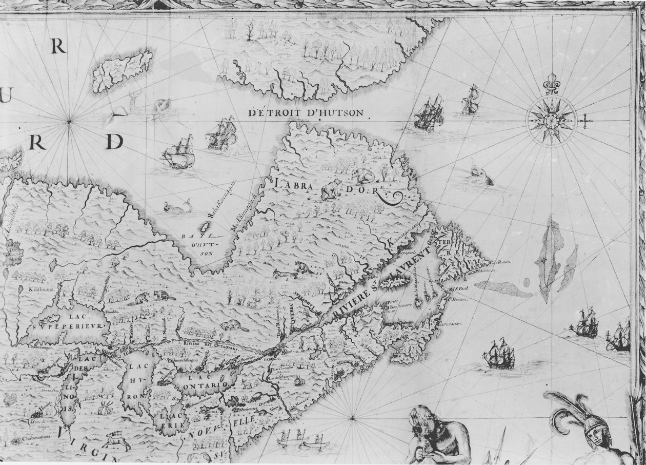
Map of New France Dedicated to Colbert by Duchesneau, Intendant (detail) by Jean Baptiste Louis Franquelin

Map of New France Dedicated to Colbert by Duchesneau, Intendant (detail)

(Map of New France dedicated to Colbert by Duchesneau, Intendant, 1681 (detail) (see also 164768))


Jean Baptiste Louis Franquelin

€ 118.92
Enthält 0% MwSt.
   Configure art print
1681  ·  Gravur  ·  Picture ID: 64887

Nonclassified artists  ·  Cartography

Map of New France Dedicated to Colbert by Duchesneau, Intendant (detail) by Jean Baptiste Louis Franquelin. Available as an art print on canvas, photo paper, watercolor board, uncoated paper or Japanese paper.
carte · jean baptiste colbert · 1619-83 · lawrence river · mouth · great lakes · labrador · newfoundland · hudson bay · baffin island · canada · canadian · Jacques Duchesneau 1650-96 · Service Historique de la Marine, Vincennes, France / Bridgeman Images
zu Favoriten hinzufügen   Add to favorites    Select wall color    View painting in a room AR/3D   View in 3D / AR
0 Reviews

Configure art print

Picture Frame

Medium & Stretcher

Glass & Passepartout

Miscellaneous & Extras

 Save / compare configuration
Preview Icon

Summary

Gemälde
Veredelung
Keilrahmen
Museumslizenz

€ 118.92
(inkl. 20% MwSt)
   Add to cart

Bildschärfe: PERFEKT

Should you desire adjustments to brightness and color, or a custom crop of the motif, we are happy to make these changes at no additional cost to you. Please do not hesitate to contact us.

Similar artworks selected for you

Map of Canada, Engraving from Survey by Samuel de Champlain Map of St. Lawrence Gulf and River, 1699 Map of New France dedicated to Colbert by Duchesneau, Intendant, 1681 Map of Normandy after an illustration from Theatrum Orbis Terrarum sive Atlas Novus by Willem and Joan Blaeu, plate representing Normandia Ducatus Map of the Strait of Magellan, plate from Oliver van Noort Map of New Amsterdam, c.1650 Island of Cuba, Florida and Gulf of Mexico, engraving from Nova Scotia and Newfoundland, from a Series of World Maps published by John Tallis und Co., New York and London, 1850s Map of the Coast of Norway and Sweden between Merdøy and Uddevalla Map of Nova Belgica or New Belgium and of Anglia Nova or New England Map of New Belgium with a View of New Amsterdam, compiled by Nicolaes Visscher c.1651-55 Map of the Coast of Norway and Sweden Between Merdøy and Uddevalla The Thames Estuary from The Sea-Mirrour atlas by Willem Janszoon Blaeu, published in Amsterdam in 1633 Linschoten Map of Caernarvon Map of the New England coastline in 1614, engraved by Simon de Passe Map from the National Library Map of Republic of Genoa, Italy Map of Lake Ontario with the English and French fleets New Belgium, plate from Bristol Channel A New and Accurate Plan of the City and Harbour of Cartagena, Showing the Descent of That Place by the British Fleet and Land Forces, Under the Command of the Admirals Vernon and Ogle and General Wentworth in March & April 1741 Map of 1590 engraved by Theodore de Bry after watercolour by the English colonist John White, governor of Roanoke. Virginia and coast with small islands and Roanoke at mouth of river. Secotan and Weapemeoc native lands The Famous West Indian Voyage Made by the English Fleet of 23 Ships and Barks Iceland, circa 1539 (detail) Map of Part of the Coast of Norway and Sweden Extreme northeast coastline of the States, in Island Elba with Piombino, Italy Virginiae Item et Floridae Americae Provinciarum, Nova Descriptio
Show more similar artworks

Other art prints by Jean Baptiste Louis Franquelin

Map of Canada from Map of New France dedicated to Colbert by Duchesneau, Intendant, 1681 Cartouche of Quebec from Map of New France Dedicated to Colbert by Duchesneau, Intendant (detail) Cartouche from View of Quebec, cartouche of a map depicting St. Lawrence River from Sorel, 1699 No. 3--124885 Franquelin
Discover more works by Jean Baptiste Louis Franquelin

Other motives from the category Cartography

Map of Central Asia Map of Asia, Published in 1700, Paris Map of Brazil, from Dutch Marine Maps, 1637 World Map Map of Animals in Europe Map of Alexandria from Mappa Mundi, 1502 Map of the Gujarat state of India, published under the direction of Colonel J.T. Walker, Surveyor General of India Map of Berlin and Coelln, 1652 Map of Britain in 665, from Map of South Kensington Detailed map of Gallipoli Peninsula and the Dardanelles Turkey, from Map of Turkey, Arabia and Persia, after Guillaume de L Map of Europe at the Time of the Third Crusade, 1190, from Map of the Kingdom of Hungary
View More from "Cartography"

Excerpt from our top sellers

Striped Jug with Spring Flowers, 1992 Sunny Path Red Vineyard at Arles Lake Thun with Niesen Isle of the Dead Sack of Rome (455) - The Destiny of Empires - Destruction - by Thomas Cole - 1836- New York Historical Society - (Rome, Roman Empire, Gaiseric, Genseric, Migration Period, Barbarian Invasions, Vandals, Fall of Western Roman Empire, Fall of Rome, Sack of Ro The Red Pines Birth of Jesus, from the Book of Hours of the Master of Jacques de Besançon Lady in the Garden Ghost of a Genius Ploughing in Nivernais, 1849 Seascape by Moonlight on the Sea Kumoi Cherry Trees The Sleeping Gypsy Mother of the World
Show More Artworks


What our customers think about us


Frequently Asked Questions about Meisterdrucke


Personalizing your art print at Meisterdrucke is a simple and intuitive process that allows you to design an artwork exactly to your specifications: Choose a frame, determine the image size, decide on a printing medium, and add suitable glazing or a stretcher frame. We also offer customization options such as mats, fillets, and spacers. Our customer service is available to help you design your perfect artwork.

At Meisterdrucke, you have the fascinating option to visualize the artwork you configured directly in your own space. For a tailored preview, simply upload a photo of your room and let the artwork appear on it. If you visit us via a mobile device, be it a phone or tablet, our augmented reality feature brings the image to life and seamlessly projects it into your space. An experience that uniquely combines art and technology.

Choosing the medium is often a matter of personal taste. To give you a clearer idea, we have provided some images for each medium. For a holistic experience, we also offer you a sample set of all paper variants so you can make a decision not just visually but also haptically. You can take advantage of the sample set free of charge – only the shipping costs will apply. You can order the sample set directly.

Do not worry. At Meisterdrucke, we do not proceed mechanically. We manually review each order. If there are any inconsistencies or peculiarities in the configuration, we will immediately contact you. Of course, our courteous and patient support is always at your side to assist you with the configuration. Together with you, we adjust your image by phone or email so that the final result exactly meets your expectations.


Do you have any questions?

Are you interested in an art print from our manufactory but still unsure? Do you need advice on choosing the medium or help with the order?

Our experts are happy to assist you.

+43 4257 29415
support@meisterdrucke.com
Mo-Do: 7:00 - 16:00 | Fr: 7:00 - 13:00

Do you have any questions?

Are you interested in an art print from our manufactory but still unsure? Do you need advice on choosing the medium or help with the order?

Our experts are happy to assist you.

+43 4257 29415
support@meisterdrucke.com
Mo-Do: 7:00 - 16:00 | Fr: 7:00 - 13:00


Meisterdrucke

   Kärntner Strasse 46
        9586 Finkenstein am Faaker See
        Austria
        +43 4257 29415
        support@meisterdrucke.com
Other languages

                   
Erfahrungen & Bewertungen zu Meisterdrucke
Partner Logos

Kaiser Franz Joseph

Meisterdrucke
Kärntner Strasse 46
9586 Finkenstein am Faaker See · Austria
+43 4257 29415 · office@meisterdrucke.com
Partner Logos


(c) 2025 meisterdrucke.us