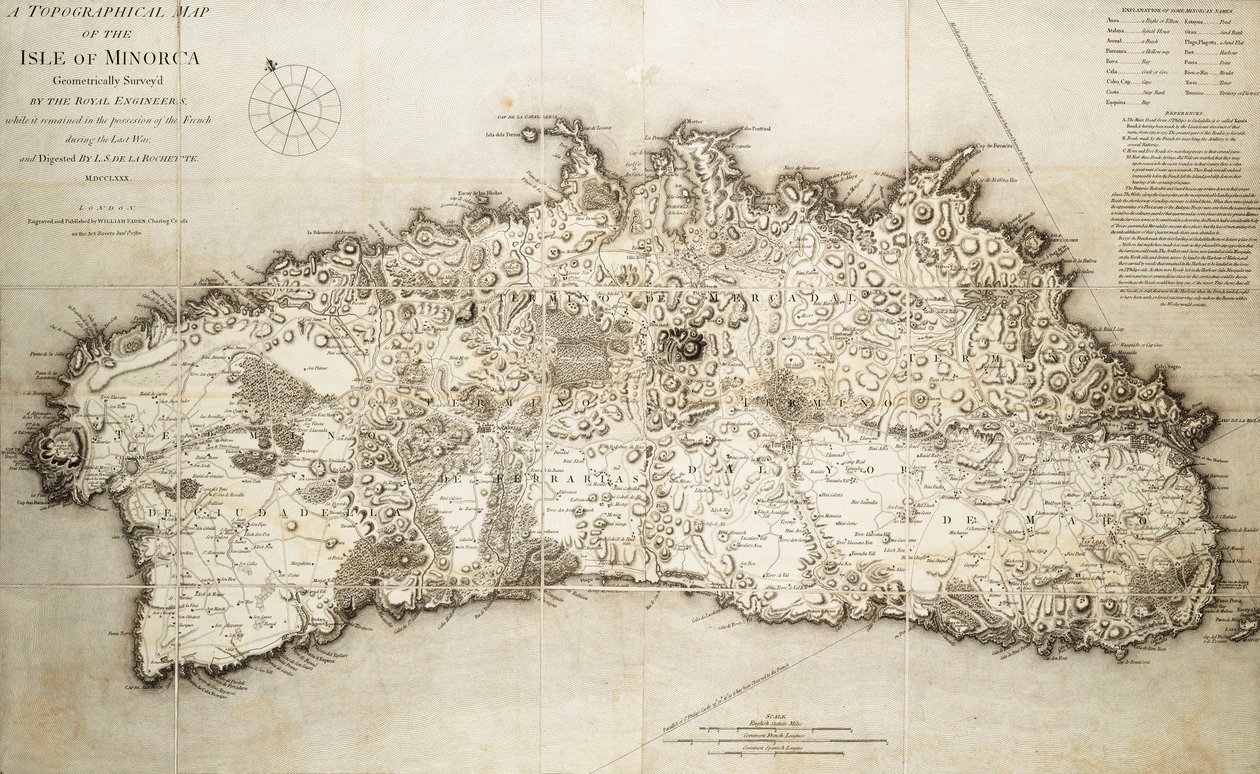
Map of Minorca by L. S. de la Rochette

Map of Minorca


L. S. de la Rochette

€ 113.45
Enthält 0% MwSt.
   Configure art print
Undated  ·  coloured engraving  ·  Picture ID: 1508690

Nonclassified artists

Map of Minorca by L. S. de la Rochette. Available as an art print on canvas, photo paper, watercolor board, uncoated paper or Japanese paper.
18th century · cartography · spain · europe · engraving · island · black and white · mzengraving · · National Maritime Museum, London, UK / Bridgeman Images
zu Favoriten hinzufügen   Add to favorites    Select wall color    View painting in a room AR/3D   View in 3D / AR
0 Reviews

Configure art print

Picture Frame

Medium & Stretcher

Glass & Passepartout

Miscellaneous & Extras

 Save / compare configuration
Preview Icon

Summary

Gemälde
Veredelung
Keilrahmen
Museumslizenz

€ 113.45
(inkl. 20% MwSt)
   Add to cart

Bildschärfe: PERFEKT

Should you desire adjustments to brightness and color, or a custom crop of the motif, we are happy to make these changes at no additional cost to you. Please do not hesitate to contact us.

Similar artworks selected for you

The Port of Mahon and surrounding area, from Cala Murte to Cala Rafalet Plano del Puerto y Rio Guayaquil en el Mar de el Sur Boston Harbour and Surroundings Corsica, France Plan of the Environs of English Harbour and Monks Hill in the Island of Antigua Surveyed and Drawn by John Brown Chart of the Island of Timor Map of the Island of Martinique Reduced from a Large One Made in the Year 1763, nd [1797] Map of Corsica (France) (etching) Map of the possessions of the republic of Genoa, including Corsica and Sardinia The Atlantic Neptune The Atlantic Neptune Map of Rhode Island at the time of its occupation 1780-81 by the French Army on the orders of Jean-Baptiste de Vimeur Count of Rochambeau Depths shown by soundings Ipswich Bay and Cape Ann Plan of the Environs of English Harbour, Antigua, c.1782 Map of Rhode Island at the time of its occupation 1780-81 by the French Army on the orders of Jean-Baptiste de Vimeur Count of Rochambeau Chart of Western Mediterranean Map of the Operations of the American Army in the Valley of Mexico in August and September 1847 during the Mexican-American War Map of Rhode Island, from Plan of Toulon Louisburg Fortress and Harbour, Cape Breton Map of the Isle of Bourbon Prepared at the Depository of Maps and Seacharts Navigation through the Straits of Sunda to Batavia Amplissima Terrae Sanctae descripto ad utriusque testamenti intelligentiam, 1537 Map of New York in 1766-67 Map of Isle of Sheppey attributed to cartographer Robert Lythe Chart of Ipswich Bay and Cape Ann, Atlantic coast of North America A new and accurate Map of the Island of Carriacou in the West Indies Early Survey of the City of New York and Its Environs to Greenwich, 1766
Show more similar artworks

Excerpt from our top sellers

Effect of Spring, Giverny, 1890 Escaping Criticism Some New Year Customs in Galloway The Family The Last Supper Carnation, Lily, Lily, Rose Reclining Female Nude Lunch The Soup, Version II Lady Godiva Pink Peach Trees (Souvenir of Mauve) The Resurrection of Christ (detail) The Birth of Venus (edited) Limits of Reason, 1927 In the Grey Melencolia I
Show More Artworks


What our customers think about us


Frequently Asked Questions about Meisterdrucke


Personalizing your art print at Meisterdrucke is a simple and intuitive process that allows you to design an artwork exactly to your specifications: Choose a frame, determine the image size, decide on a printing medium, and add suitable glazing or a stretcher frame. We also offer customization options such as mats, fillets, and spacers. Our customer service is available to help you design your perfect artwork.

At Meisterdrucke, you have the fascinating option to visualize the artwork you configured directly in your own space. For a tailored preview, simply upload a photo of your room and let the artwork appear on it. If you visit us via a mobile device, be it a phone or tablet, our augmented reality feature brings the image to life and seamlessly projects it into your space. An experience that uniquely combines art and technology.

Choosing the medium is often a matter of personal taste. To give you a clearer idea, we have provided some images for each medium. For a holistic experience, we also offer you a sample set of all paper variants so you can make a decision not just visually but also haptically. You can take advantage of the sample set free of charge – only the shipping costs will apply. You can order the sample set directly.

Do not worry. At Meisterdrucke, we do not proceed mechanically. We manually review each order. If there are any inconsistencies or peculiarities in the configuration, we will immediately contact you. Of course, our courteous and patient support is always at your side to assist you with the configuration. Together with you, we adjust your image by phone or email so that the final result exactly meets your expectations.


Do you have any questions?

Are you interested in an art print from our manufactory but still unsure? Do you need advice on choosing the medium or help with the order?

Our experts are happy to assist you.

+43 4257 29415
support@meisterdrucke.com
Mo-Do: 7:00 - 16:00 | Fr: 7:00 - 13:00

Do you have any questions?

Are you interested in an art print from our manufactory but still unsure? Do you need advice on choosing the medium or help with the order?

Our experts are happy to assist you.

+43 4257 29415
support@meisterdrucke.com
Mo-Do: 7:00 - 16:00 | Fr: 7:00 - 13:00


Meisterdrucke

   Kärntner Strasse 46
        9586 Finkenstein am Faaker See
        Austria
        +43 4257 29415
        support@meisterdrucke.com
Other languages

                   
Erfahrungen & Bewertungen zu Meisterdrucke
Partner Logos

Kaiser Franz Joseph

Meisterdrucke
Kärntner Strasse 46
9586 Finkenstein am Faaker See · Austria
+43 4257 29415 · office@meisterdrucke.com
Partner Logos


(c) 2025 meisterdrucke.us