Search by artist, work title or style – e.g. Monet, Starry Night, Impressionism, Hokusai wave, nude. Describe the scene – e.g. green meadow, abstract with lots of red, dark oil painting, standing nude next to a tree.

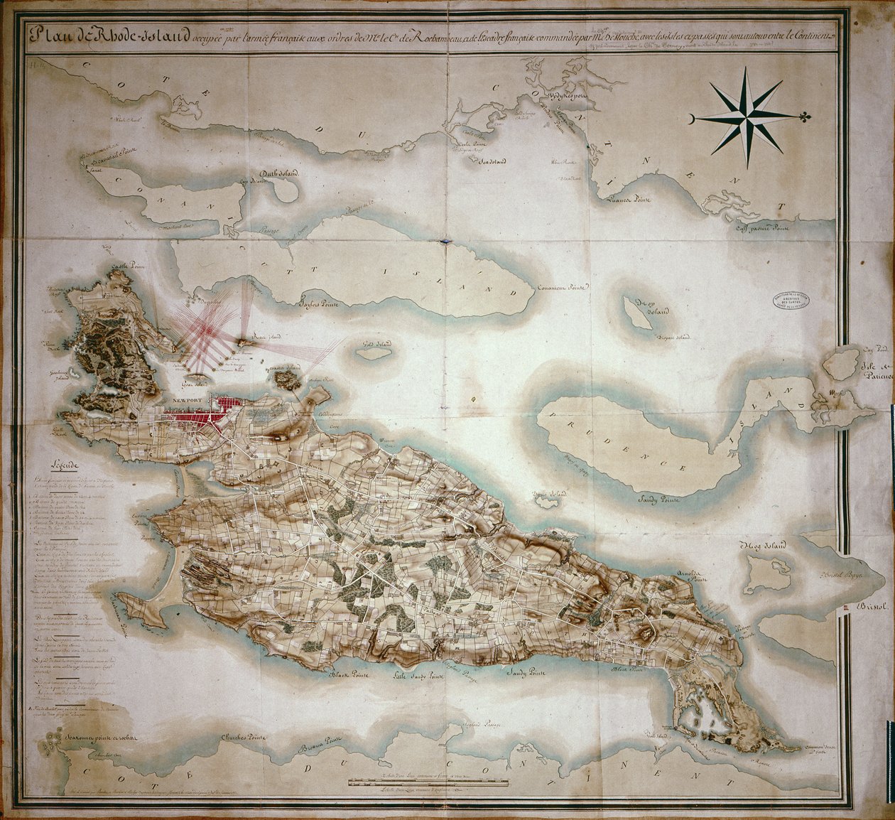
Map of Rhode Island at the time of its occupation 1780-81 by the French Army on the orders of Jean-Baptiste de Vimeur Count of Rochambeau by French School

Map of Rhode Island at the time of its occupation 1780-81 by the French Army on the orders of Jean-Baptiste de Vimeur Count of Rochambeau

(Map of Rhode Island at the time of its occupation 1780-81 by the French Army on the orders of Jean-Baptiste de Vimeur (1725-1807) Count of Rochambeau )


French School

€ 106.47
Enthält 0% MwSt.
   Configure art print
Undated  ·  coloured lithograph  ·  Picture ID: 427446

Cultural Circles  ·  Cartography

Map of Rhode Island at the time of its occupation 1780-81 by the French Army on the orders of Jean-Baptiste de Vimeur Count of Rochambeau by French School. Available as an art print on canvas, photo paper, watercolor board, uncoated paper or Japanese paper.
cartography · cartographical · Service Historique de la Marine, Vincennes, France / Bridgeman Images
AR/3D   View in 3D / AR zu Favoriten hinzufügen   Add to favorites    Select wall color    View painting in a room
0 Reviews

Configure art print

Picture Frame

Medium & Stretcher

Glass & Passepartout

Miscellaneous & Extras

 Save / compare configuration
Preview Icon

Summary

Gemälde
Veredelung
Keilrahmen
Museumslizenz

€ 106.47
(inkl. 20% MwSt)
   Add to cart

Bildschärfe: PERFEKT

Should you desire adjustments to brightness and color, or a custom crop of the motif, we are happy to make these changes at no additional cost to you. Please do not hesitate to contact us.

Similar artworks selected for you

Plan of the taking of Barasound in Finland Outline of the Island of St. John of Puerto Rico Roy Military Survey of Scotland Geographic Map of the Azores Map of the Island of Puerto Rico, 1599 Chart of the Island of Timor Plan of the Harbour, Fort, Town and Environs of Fort Royal in Martinique Map of the Bay of Rio de Janeiro Hampshire or the County of Southampton Including the Isle of Wight Ipswich Bay and Cape Ann Map of Minorca A new and accurate Map of the Island of Carriacou in the West Indies Map of the Isle of Bourbon Prepared at the Depository of Maps and Seacharts Draught of the Island Rattan in the Bay of Honduras in Latitude 16 Degrees 22 Geographic map of Mauritius (Anc. Ile de France) Map from the National Library Map of the Island of Martinique, the Island of Saintes and the Island of Marie Galante in the West Indies S. Phelipe de Porto Bello Plano del Puerto y Rio Guayaquil en el Mar de el Sur Map of the Island of Martinique Reduced from a Large One Made in the Year 1763, nd [1797] Coast of Hancock County, Maine The Virgin Islands from English and Danish Surveys French chart of Malta, c.1798 A Correct Draught of the Harbours of Port Royal and Kingston, with the Keys and Shoals Adjacent &c. from a Late Accurate Survey, by Mr. Richd Jones, Engineer Isles of Scilly Map of the bay and city of S. Phelipe de Portobelo Crete A Plan of Rhode Island by Holland Map of Mauritius, illustration from
Show more similar artworks

Other art prints by French School

Birth of Jesus, from the Book of Hours of the Master of Jacques de Besançon Genealogical Tree of the Rougon-Macquart Family Poster Advertising the Baron Hotel in Aleppo The Shield of Achilles, After the Description in Homer Beef: Diagram Depicting the Different Cuts of Meat The Carte du Tendre, a map of an imaginary country, from volume II of Clelie written by Mademoiselle de Scudery, engraved by Francois Chauveau (1613-76) 1656 Reproduction of Map of Routes of St. James of Compostel, Originally Engraved by D. Serveaux 1648 Poster advertising Pur Champagne, from Damery, Epernay Lyrics to Poster advertising Maggi Cuts of Pork, illustration from a French Domestic Science Manual by H. de Puytorac, published by Editions Fernand Nathan, late 19th century Veal: diagram depicting the different cuts of meat The Man with Six Heads, Caricature of Charles Maurice de Talleyrand-Perigord, 1815 Interior of the Alhambra, Granada Frederic Chopin (1810-49) Engraved from a Daguerrotype
Discover more works by French School

Other motives from the category Cartography

Map of Brazil, from Dutch Marine Maps, 1637 Map of Rome, from Map of Jerusalem, from Map of Zurich, from Map of Athens and Its Vicinity; The Acropolis Map of Animals in Africa Kent, plate 39r, from A Compleat Sett of Mapps of England and Wales in General..., 1724 Map of the Island of Tinos with the Venetian Fleet, 17th Century Map of Alexandria from Map of the Caribbean Islands and the American State of Florida Londinium Antiqua, map of London, published by William Darton, 1563 Map of the Kingdom of Hungary East Africa and the Red Sea with Prester John and the Legendary Kings of Africa, detail from a map of the Mediterranean Sea by Vesconte de Maggiolo, 1563 Map of Crompond, from Map of the East Riding of Yorkshire
View More from "Cartography"

Excerpt from our top sellers

The Destruction of an Empire Woman on the Beach The Hay Wain Winter Landscape with Skaters Three White Cottages in Saintes-Maries Lake Thun with Niesen Richelieu (1585-1642) on the Sea Wall at La Rochelle, 1881 Cat in a Rainbow Starry Night, c.1850-65 The Cliff, Étretat, Sunset Trail in the Woods The Kiss Genealogical Tree of the Rougon-Macquart Family Carnation, Lily, Lily, Rose Vertumnus
Show More Artworks


What our customers think about us


Frequently Asked Questions about Meisterdrucke


Personalizing your art print at Meisterdrucke is a simple and intuitive process that allows you to design an artwork exactly to your specifications: Choose a frame, determine the image size, decide on a printing medium, and add suitable glazing or a stretcher frame. We also offer customization options such as mats, fillets, and spacers. Our customer service is available to help you design your perfect artwork.

At Meisterdrucke, you have the fascinating option to visualize the artwork you configured directly in your own space. For a tailored preview, simply upload a photo of your room and let the artwork appear on it. If you visit us via a mobile device, be it a phone or tablet, our augmented reality feature brings the image to life and seamlessly projects it into your space. An experience that uniquely combines art and technology.

Choosing the medium is often a matter of personal taste. To give you a clearer idea, we have provided some images for each medium. For a holistic experience, we also offer you a sample set of all paper variants so you can make a decision not just visually but also haptically. You can take advantage of the sample set free of charge – only the shipping costs will apply. You can order the sample set directly.

Do not worry. At Meisterdrucke, we do not proceed mechanically. We manually review each order. If there are any inconsistencies or peculiarities in the configuration, we will immediately contact you. Of course, our courteous and patient support is always at your side to assist you with the configuration. Together with you, we adjust your image by phone or email so that the final result exactly meets your expectations.


Do you have any questions?

Are you interested in an art print from our manufactory but still unsure? Do you need advice on choosing the medium or help with the order?

Our experts are happy to assist you.

+43 4257 29415
support@meisterdrucke.com
Mo-Do: 7:00 - 16:00 | Fr: 7:00 - 13:00

Do you have any questions?

Are you interested in an art print from our manufactory but still unsure? Do you need advice on choosing the medium or help with the order?

Our experts are happy to assist you.

+43 4257 29415
support@meisterdrucke.com
Mo-Do: 7:00 - 16:00 | Fr: 7:00 - 13:00


Meisterdrucke

   Kärntner Strasse 46
        9586 Finkenstein am Faaker See
        Austria
        +43 4257 29415
        support@meisterdrucke.com
Other languages

                   
Erfahrungen & Bewertungen zu Meisterdrucke
Post.at DHL Express Quehenberger Cargoboard
Kaiser Franz Joseph

Meisterdrucke
Kärntner Strasse 46
9586 Finkenstein am Faaker See · Austria
+43 4257 29415 · office@meisterdrucke.com
Post.at DHL Express Quehenberger Cargoboard


Meisterdrucke 2752 Bewertungen auf ProvenExpert.com

(c) 2025 meisterdrucke.us