Search by artist, work title or style – e.g. Monet, Starry Night, Impressionism, Hokusai wave, nude. Describe the scene – e.g. green meadow, abstract with lots of red, dark oil painting, standing nude next to a tree.

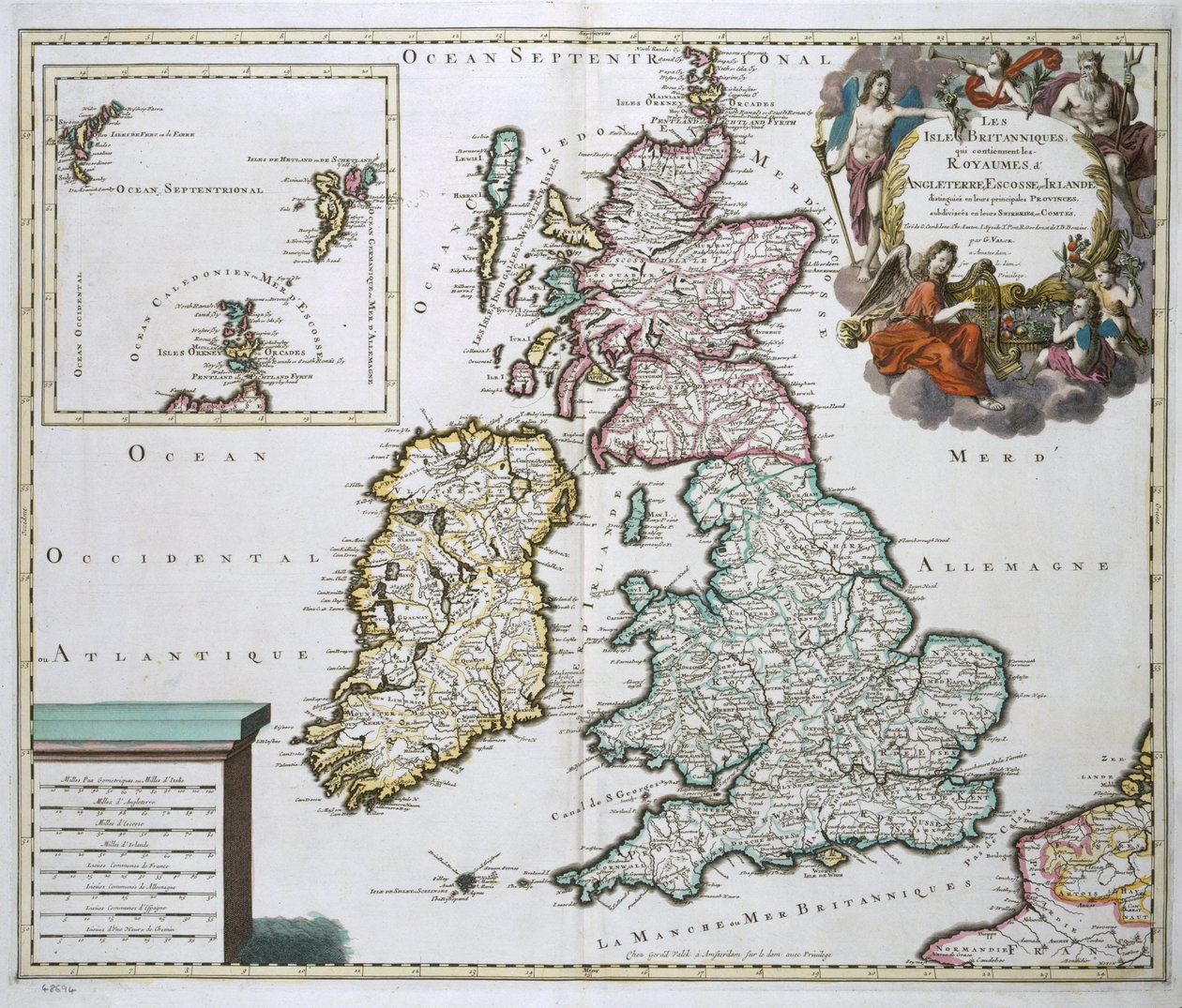
Map of Britain and Ireland by Gerard Valck

Map of Britain and Ireland

(Map of Britain and Ireland (colour engraving))


Gerard Valck

€ 111.16
Enthält 0% MwSt.
   Configure art print
Undated  ·  colour engraving  ·  Picture ID: 44331

Nonclassified artists  ·  Cartography

Map of Britain and Ireland by Gerard Valck. Available as an art print on canvas, photo paper, watercolor board, uncoated paper or Japanese paper.
shetland · orkney · faroe isles · cartography · geography · geographical · mapping · great britain · Private Collection / Bridgeman Images
Other color variations of this picture  
AR/3D   View in 3D / AR zu Favoriten hinzufügen   Add to favorites    Select wall color    View painting in a room
0 Reviews

Configure art print

Picture Frame

Medium & Stretcher

Glass & Passepartout

Miscellaneous & Extras

 Save / compare configuration
Preview Icon

Summary

Gemälde
Veredelung
Keilrahmen
Museumslizenz

€ 111.16
(inkl. 20% MwSt)
   Add to cart

Bildschärfe: PERFEKT

Should you desire adjustments to brightness and color, or a custom crop of the motif, we are happy to make these changes at no additional cost to you. Please do not hesitate to contact us.

Similar artworks selected for you

British Islands: England, Scotland, and Ireland Map of the kingdoms of England, Scotland and Ireland Britain As It Was Divided In The Time of the English Saxons, 1616 Great Britain and Ireland from Theatrum Orbis Terrarum by Willem Bleau, Amsterdam A New Map of England Scotland and Ireland, c.1690 Map of Scotland, c.1700 Most Accurate Description of the Kingdom of England and the Principality of Wales Ireland and Great Britain, in Map of Britain and Ireland, published Paris 1640 Britain As It Was Divided In The Time of the English Saxons especially during their Heptarchy Map of Britain, 1631 Great Britain, in The British Isles in which are found Albion or Greater Britain and Ivernia or Lesser Britain, engraving by G. Zuliani taken from Tome I of the Newest Atlas published in Venice in 1785 by Antonio Zatta Map of the Kingdom of Great Britain and Ireland, 1610 Geographic Map Representing England and Ireland. Atlas by G. Delysle Map of Ireland showing the Provinces of Ulster, Munster, Connaught and Leinster, by Johann B. Homann, c.1730 Kingdom of Scotland A New and Exact Map of England Kingdoms of England and Ireland Scotland, in Map Depicting The Invasions of England and Ireland With All Their Civil Wars Since the Conquest, c.1627 Britannia Atlas A Map of England The Invasions of England and Ireland with All Their Civil Wars Since the Conquest, c.1627 Ancient Description of the British Isles
Show more similar artworks

Other art prints by Gerard Valck

Noble River Elbe, Collected and Published with Great Care from Various Famous Authors Chapter II from II Kings, The Translation of Elijah Portrait of Maurice, Prince of Orange Hermes Orders Calypso to Release Odysseus Bathsheba Receives the Message from David (Missio de Davide ad Bathsebam) Bathsheba Receives the Message from David Copernican Planisphere, or, System of the Entire Created Universe Presented on a Plane According to the Copernican Hypothesis Bathsheba Receives David General Map of Lorraine divided into its Duchy and Barrois Map of Britain and Ireland Eastern Part of the Austrian Circle Vertumnus and Pomona Abruzzo Citra and Ultra Paraguay Province of Rio de la Plata with Adjacent Regions Tucuman and Santa Cruz de la Sierra Vertumnus and Pomona
Discover more works by Gerard Valck

Other motives from the category Cartography

Detail of Constantinople and the Middle East from the Peutinger Map Copy Map of the World, designed by Sebastien Cabot (c.1476-1557), 1544 Map and Prospect of London, c.1710 Map of the Sea of Maluku, from the Cosmographie Universelle View of Quebec, cartouche of a map depicting St. Lawrence River from Sorel, 1699 Map of Phillipsburg, from Map of the Black Sea Plan and Map of Saint-Jean-Pied-de-Port, from the Atlas Louis XIV, 1683-88 Map of Metropolitan London Showing the Parliamentary Boroughs and Divisions, 1885 Map of Rome, from the Map of Westminster from New and accurate map of the West Indies Map of Europe, Published in 1700, Paris Map of Bas Poitou, Pays d Map of the Eastern Mediterranean
View More from "Cartography"

Excerpt from our top sellers

Mont Sainte-Victoire Swimming Pool Cypresses Ruby, Gold and Malachite The Isle of the Dead Tetrahedra Four Foxes Elizabeth of Bavaria (1837-98), Empress of Austria, Wife of Emperor Franz Joseph of Austria (1830-1916) Head of a Skeleton with a Burning Cigarette The Milkmaid Standing Male Nude Abbey in the Oakwood Sunflowers Mother Mushroom with Her Children, c.1900 Annunciation (post restoration)
Show More Artworks


What our customers think about us


Frequently Asked Questions about Meisterdrucke


Personalizing your art print at Meisterdrucke is a simple and intuitive process that allows you to design an artwork exactly to your specifications: Choose a frame, determine the image size, decide on a printing medium, and add suitable glazing or a stretcher frame. We also offer customization options such as mats, fillets, and spacers. Our customer service is available to help you design your perfect artwork.

At Meisterdrucke, you have the fascinating option to visualize the artwork you configured directly in your own space. For a tailored preview, simply upload a photo of your room and let the artwork appear on it. If you visit us via a mobile device, be it a phone or tablet, our augmented reality feature brings the image to life and seamlessly projects it into your space. An experience that uniquely combines art and technology.

Choosing the medium is often a matter of personal taste. To give you a clearer idea, we have provided some images for each medium. For a holistic experience, we also offer you a sample set of all paper variants so you can make a decision not just visually but also haptically. You can take advantage of the sample set free of charge – only the shipping costs will apply. You can order the sample set directly.

Do not worry. At Meisterdrucke, we do not proceed mechanically. We manually review each order. If there are any inconsistencies or peculiarities in the configuration, we will immediately contact you. Of course, our courteous and patient support is always at your side to assist you with the configuration. Together with you, we adjust your image by phone or email so that the final result exactly meets your expectations.


Do you have any questions?

Are you interested in an art print from our manufactory but still unsure? Do you need advice on choosing the medium or help with the order?

Our experts are happy to assist you.

+43 4257 29415
support@meisterdrucke.com
Mo-Do: 7:00 - 16:00 | Fr: 7:00 - 13:00

Do you have any questions?

Are you interested in an art print from our manufactory but still unsure? Do you need advice on choosing the medium or help with the order?

Our experts are happy to assist you.

+43 4257 29415
support@meisterdrucke.com
Mo-Do: 7:00 - 16:00 | Fr: 7:00 - 13:00


Meisterdrucke

   Kärntner Strasse 46
        9586 Finkenstein am Faaker See
        Austria
        +43 4257 29415
        support@meisterdrucke.com
Other languages

                   
Erfahrungen & Bewertungen zu Meisterdrucke
Post.at DHL Express Quehenberger Cargoboard
Kaiser Franz Joseph

Meisterdrucke
Kärntner Strasse 46
9586 Finkenstein am Faaker See · Austria
+43 4257 29415 · office@meisterdrucke.com
Post.at DHL Express Quehenberger Cargoboard


Meisterdrucke 2752 Bewertungen auf ProvenExpert.com

(c) 2025 meisterdrucke.us