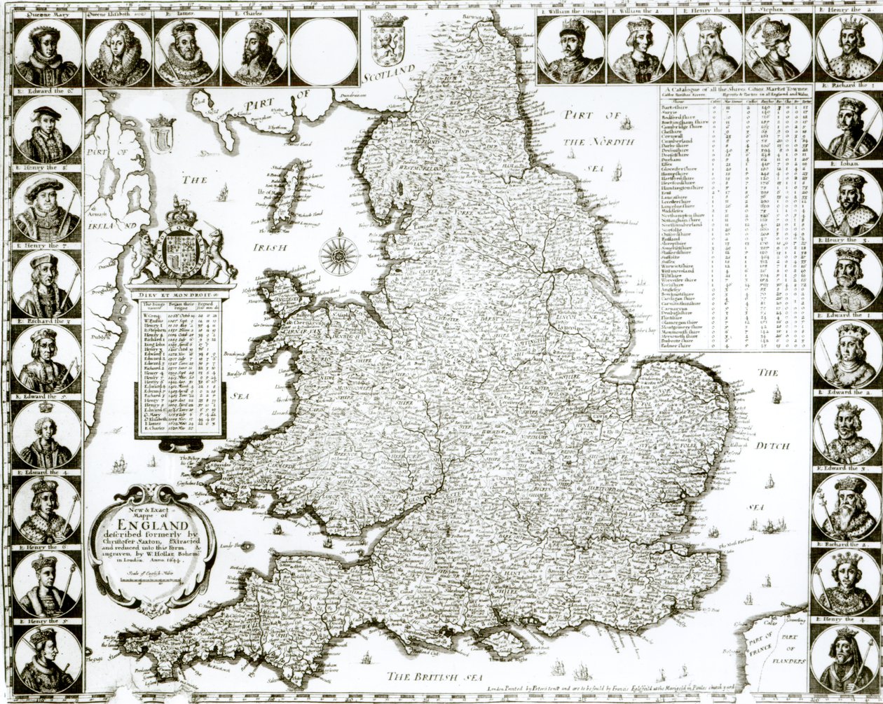
Map of England and Wales by Wenceslaus Hollar

Map of England and Wales

(Map of England and Wales, 1644 )


Wenceslaus Hollar

€ 0.00
Enthält ??% MwSt.
   Add to cart
   Configure art print
1644  ·  Gravur  ·  Picture ID: 63266

Baroque  ·  Cartography

Map of England and Wales by Wenceslaus Hollar. Available as an art print on canvas, photo paper, watercolor board, uncoated paper or Japanese paper.
cartography · mapping · shires · cities · market towns · coat of arms · kings · british sea · north sea · irish sea · ships · mapping
Other color variations of this picture  
zu Favoriten hinzufügen   Add to favorites    Select wall color    View painting in a room AR/3D   View in 3D / AR
0 Reviews

Configure art print

Picture Frame

Medium & Stretcher

Glass & Passepartout

Miscellaneous & Extras

 Save / compare configuration
Preview Icon

Summary

Gemälde
Veredelung
Keilrahmen
Museumslizenz

€ ???.??
(inkl. 20% MwSt)
   Add to cart

Produktionszeit: 2-4 Werktage
Bildschärfe: PERFEKT

Should you desire adjustments to brightness and color, or a custom crop of the motif, we are happy to make these changes at no additional cost to you. Please do not hesitate to contact us.

Similar artworks selected for you

A New Map of the Kingdom of England and the Principality of Wales, 1669 Britain As It Was Divided In The Time of the English Saxons, 1616 Map of Britain and Ireland Most Accurate Description of the Kingdom of England and the Principality of Wales Grat Britain et Ireland Britain As It Was Divided In The Time of the English Saxons especially during their Heptarchy Map of England, Scotland and Ireland (Great Britain) Ancient Description of the British Isles Map of the Kingdom of Great Britain and Ireland, 1610 Britannia Atlas The Kingdom of England (engraved by Jodocus Hondius) Map of England, Wales and Ireland, Theatrum Orbis Terrarum by Abraham Ortelius The Invasions of England and Ireland with All Their Civil Wars Since the Conquest, c.1627 England Britania Insula quae dup Regna continet Angliam et Scotiam cum Hibernia adiacente, engraved by Paulo Forlani, 1562 A New Map of England Scotland and Ireland, c.1690 New map of the most flourishing kingdom of England, by Humphrey Lloyd of Denbigh Map of the kingdoms of England, Scotland and Ireland Map of England and Ireland drawn in 1606 (coloured engraving) Ireland and Great Britain, in Map of Britain and Ireland, published Paris 1640 Map Depicting The Invasions of England and Ireland With All Their Civil Wars Since the Conquest, c.1627 Anglia: England and Wales. 1579 A Map of England Great Britain and Ireland from Theatrum Orbis Terrarum by Willem Bleau, Amsterdam Anglia: England and Wales Wales, engraved by Jodocus Hondius from John Speed
Show more similar artworks

Other art prints by Wenceslaus Hollar

A Young Man Caressing an Old Woman Head of a bald man in profile to left, 1644-52 Map of London After the Great Fire of 1666 Grotesque Old Man with Flattened Nose in Profile to Left Merchant Portrait of an Old Man with Pronounced Chin Allegory of the Peace of Westphalia, 1648 Frieze with Study Heads / Caricatures of the King and Queen of Tunisia Scottish Woman London, before and after the Great Fire Head of a Man with Curly Hair, in Profile Map of England and Wales Theophrastus Bombastus von Hohenheim Paracelsus, Swiss Alchemist and Physician Map of the City of Florence Map of Oxford
Discover more works by Wenceslaus Hollar

Other motives from the category Cartography

Map of Central Europe (detail) Map of Turkey, Middle East Horn of Africa and Persian Gulf in the 1890s, from Map of the Indian Peninsula Map Showing the New Frontier Line Between Russia and Turkey as Settled by the Treaty, 30 March 1856 Photograph of a French Map Showing the Battlefields of Verdun, September 1916 Map of the Caribbean Islands and the American State of Florida Map of the Battle of Craone Map of Jerusalem and the Surrounding Area Map of London in the 11th Century Map of Canada from Map of Algeria Map of Africa, Published in 1700, Paris Map of Nouvelle-France (Canada) 1699 Bethlehem (detail) Map of the Island of Haiti
View More from "Cartography"

Excerpt from our top sellers

Starry Night Yellow Red Blue The Wanderer above the Sea of Fog The Resurrection The Siren (Green Abyss) Mary Celeste The Harvest Marine (or Marine, Regattas at Villers) The Interior of the Palm House Bauhaus Staircase Ariadne Abandoned by Theseus Portrait of the Marchesa Luisa Casati, with a Greyhound Destruction of Leviathan - Engraving in Anastasis Fresco (detail) Donald Trump Portrait
Show More Artworks


What our customers think about us


Frequently Asked Questions about Meisterdrucke


Personalizing your art print at Meisterdrucke is a simple and intuitive process that allows you to design an artwork exactly to your specifications: Choose a frame, determine the image size, decide on a printing medium, and add suitable glazing or a stretcher frame. We also offer customization options such as mats, fillets, and spacers. Our customer service is available to help you design your perfect artwork.

At Meisterdrucke, you have the fascinating option to visualize the artwork you configured directly in your own space. For a tailored preview, simply upload a photo of your room and let the artwork appear on it. If you visit us via a mobile device, be it a phone or tablet, our augmented reality feature brings the image to life and seamlessly projects it into your space. An experience that uniquely combines art and technology.

Choosing the medium is often a matter of personal taste. To give you a clearer idea, we have provided some images for each medium. For a holistic experience, we also offer you a sample set of all paper variants so you can make a decision not just visually but also haptically. You can take advantage of the sample set free of charge – only the shipping costs will apply. You can order the sample set directly.

Do not worry. At Meisterdrucke, we do not proceed mechanically. We manually review each order. If there are any inconsistencies or peculiarities in the configuration, we will immediately contact you. Of course, our courteous and patient support is always at your side to assist you with the configuration. Together with you, we adjust your image by phone or email so that the final result exactly meets your expectations.


Do you have any questions?

Are you interested in an art print from our manufactory but still unsure? Do you need advice on choosing the medium or help with the order?

Our experts are happy to assist you.

+43 4257 29415
support@meisterdrucke.com
Mo-Do: 7:00 - 16:00 | Fr: 7:00 - 13:00

Do you have any questions?

Are you interested in an art print from our manufactory but still unsure? Do you need advice on choosing the medium or help with the order?

Our experts are happy to assist you.

+43 4257 29415
support@meisterdrucke.com
Mo-Do: 7:00 - 16:00 | Fr: 7:00 - 13:00


Meisterdrucke

   Kärntner Strasse 46
        9586 Finkenstein am Faaker See
        Austria
        +43 4257 29415
        support@meisterdrucke.com
Other languages

                   
Erfahrungen & Bewertungen zu Meisterdrucke
Partner Logos

Kaiser Franz Joseph

Meisterdrucke
Kärntner Strasse 46
9586 Finkenstein am Faaker See · Austria
+43 4257 29415 · office@meisterdrucke.com
Partner Logos


(c) 2023 meisterdrucke.us