Search by artist, work title or style – e.g. Monet, Starry Night, Impressionism, Hokusai wave, nude. Describe the scene – e.g. green meadow, abstract with lots of red, dark oil painting, standing nude next to a tree.

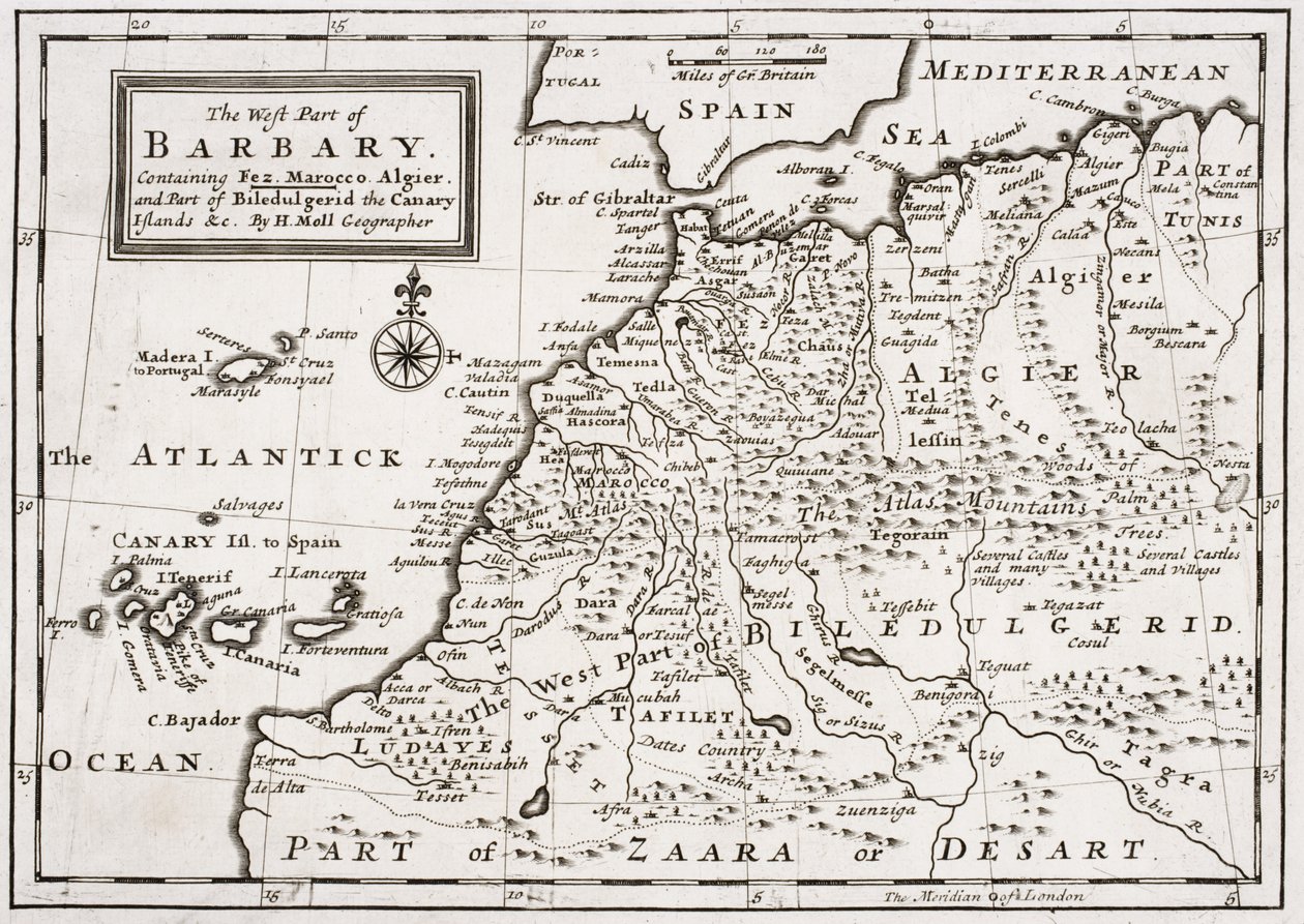
Map of The West Part of Barbary, c.1720 by Hermann Moll

Map of The West Part of Barbary, c.1720

(Map of The West Part of Barbary, c.1720 )


Hermann Moll

€ 125.03
Enthält 0% MwSt.
   Configure art print
Undated  ·  lithograph  ·  Picture ID: 51732

Nonclassified artists  ·  Cartography

Map of The West Part of Barbary, c.1720 by Hermann Moll. Available as an art print on canvas, photo paper, watercolor board, uncoated paper or Japanese paper.
north africa · african · spain · mediterranean · morocco · algeria · zaara desart · sahara desert · tunis · tunisia · Private Collection / Bridgeman Images
AR/3D   View in 3D / AR zu Favoriten hinzufügen   Add to favorites    Select wall color    View painting in a room
0 Reviews

Configure art print

Picture Frame

Medium & Stretcher

Glass & Passepartout

Miscellaneous & Extras

 Save / compare configuration
Preview Icon

Summary

Gemälde
Veredelung
Keilrahmen
Museumslizenz

€ 125.03
(inkl. 20% MwSt)
   Add to cart

Bildschärfe: PERFEKT

Should you desire adjustments to brightness and color, or a custom crop of the motif, we are happy to make these changes at no additional cost to you. Please do not hesitate to contact us.

Similar artworks selected for you

South-east Veneto, north-east Emilia-Romagna, Italy Molise, Benevento, Avellino, Italy, in Countries of Ancient France, in Spanish Province Asturias, Castile and León, including the towns of Oviedo, Leon, Santander, Valladolid, in Map of the Area of Padua and Polesine (Italy) Bourdelois, Land of Medoc and the Provost of Born Galicia, Spain, in Map of Asturias (Spain) Verona, Italy, in Historical Geographical Map of Palestine. Jansson Atlas Map of the Biscay Province (Spain) and the Kingdom of Navarre (France) Bay of Bengal Map of Savoy and Piedmont Duchy of Parma and Piacenza Map of Egypt - engraving by Dapper Switzerland (Canton: Vaud, Valais), Italy (Region: Aosta Valley, Piedmont), France (Region: Franche-Comté, Rhône-Alpes) Map of the Province of Picardie (France) (etching) North Africa with siege of Tunis and Nile delta (engraving) Map of the Kingdom of Prussia (Germany) Picardy, France Galicia, Principado de Asturias, Cantabria, Castile and León, Spain Cantabria, Basque Country, Navarre, La Rioja, Castile and León, Spain Pomeranian, Kuyavian-Pomeranian, Masovian, Warmian-Masurian, Podlaskie, Kaliningrad Oblast, Germany Poitou-Charentes, France South Portugal, Galicia and Asturias Poitou-Charentes with Île d Principality of Piedmont, Duchy of Monferrato, Western Liguria and Part of Eastern Liguria Region Map of Poitou-Charentes (France) (engraving) Portugal
Show more similar artworks

Other art prints by Hermann Moll

A new and correct map of the world laid down according to the newest discoveries and from the most exact observations Village of the Susquehanna People, Susquehanna River (detail) published as inset in Hermann Moll Map of The West Part of Barbary, c.1720 Map of the Caribbean, 1715 A New and Correct Map of the World, Laid Down According to the Newest Discoveries, and from the Most Exact Observations, by Herman Moll, Geographer A View of the General and Coasting Trade-Winds, Monsoons or the Shifting Trade Winds Through the World, Variations... According to the Newest and Most Exact Observations Map of the Dominions of Great Britain in North America, 1711 The Turkish Empire in Europe, Asia and Africa Map of Spain and Portugal Map of Africa, c.1715 A Chart of the Sea Coast from England to the Straits A New and Exact Map of the Coast Countries and Islands Within Ye Limits of Ye South Sea Company Congo. Angola. Cafres. Monoemugi. Monomotapa. Zanguebar & Madagascar, 1701 The Empire of China and Island of Japan Map of South America, c.1715
Discover more works by Hermann Moll

Other motives from the category Cartography

Map Showing the Principal Stars Visible in Great Britain (Plate XXIX), from Map of Raleigh Civil War Map of General Sherman Map of Mexico and Central America Map of Flanders, after cartographer Matthias Quad from his Topographical Map and Survey of the Village of Issy, 1740 Maps of the Battle of Gross Beeren and Battle of Dennewitz, published by William Blackwood and Sons, Edinburgh and London, 1848 Map of the Battle of Craone Map of South East Asia, 1687 Map of Paris, 1620 (detail) Map of the Great Lakes Map of Arnhem, Velmo, Gelre, and Ruerm (from Van Diemen The Graphic Map of European Possessions in Africa Map of Ancient Egypt
View More from "Cartography"

Excerpt from our top sellers

The School Walk, 1872 View of Delft The Ice Sea Map of the Battle of Trafalgar, published by William Blackwood and Sons, Edinburgh and London Illustration to the Divine Comedy by Dante Alighieri Abyss of Hell Girl with a Rake in Fjord Landscape Danaë Beat the Whites with the Red Wedge Poster Study for Pine Forest (Left Panel) P.S. Krøyer Daniel in the Lions Den Strolling along the Seashore, 1909 Krumau Houses in Munich, 1908
Show More Artworks


What our customers think about us


Frequently Asked Questions about Meisterdrucke


Personalizing your art print at Meisterdrucke is a simple and intuitive process that allows you to design an artwork exactly to your specifications: Choose a frame, determine the image size, decide on a printing medium, and add suitable glazing or a stretcher frame. We also offer customization options such as mats, fillets, and spacers. Our customer service is available to help you design your perfect artwork.

At Meisterdrucke, you have the fascinating option to visualize the artwork you configured directly in your own space. For a tailored preview, simply upload a photo of your room and let the artwork appear on it. If you visit us via a mobile device, be it a phone or tablet, our augmented reality feature brings the image to life and seamlessly projects it into your space. An experience that uniquely combines art and technology.

Choosing the medium is often a matter of personal taste. To give you a clearer idea, we have provided some images for each medium. For a holistic experience, we also offer you a sample set of all paper variants so you can make a decision not just visually but also haptically. You can take advantage of the sample set free of charge – only the shipping costs will apply. You can order the sample set directly.

Do not worry. At Meisterdrucke, we do not proceed mechanically. We manually review each order. If there are any inconsistencies or peculiarities in the configuration, we will immediately contact you. Of course, our courteous and patient support is always at your side to assist you with the configuration. Together with you, we adjust your image by phone or email so that the final result exactly meets your expectations.


Do you have any questions?

Are you interested in an art print from our manufactory but still unsure? Do you need advice on choosing the medium or help with the order?

Our experts are happy to assist you.

+43 4257 29415
support@meisterdrucke.com
Mo-Do: 7:00 - 16:00 | Fr: 7:00 - 13:00

Do you have any questions?

Are you interested in an art print from our manufactory but still unsure? Do you need advice on choosing the medium or help with the order?

Our experts are happy to assist you.

+43 4257 29415
support@meisterdrucke.com
Mo-Do: 7:00 - 16:00 | Fr: 7:00 - 13:00


Meisterdrucke

   Kärntner Strasse 46
        9586 Finkenstein am Faaker See
        Austria
        +43 4257 29415
        support@meisterdrucke.com
Other languages

                   
Erfahrungen & Bewertungen zu Meisterdrucke
Post.at DHL Express Quehenberger Cargoboard
Kaiser Franz Joseph

Meisterdrucke
Kärntner Strasse 46
9586 Finkenstein am Faaker See · Austria
+43 4257 29415 · office@meisterdrucke.com
Post.at DHL Express Quehenberger Cargoboard


Meisterdrucke 2764 Bewertungen auf ProvenExpert.com

(c) 2025 meisterdrucke.us